Maioka Station
Appearance
B07 Maioka Station 舞岡駅 | |||||||||||
|---|---|---|---|---|---|---|---|---|---|---|---|
 Exit No.1 of Maioka Station | |||||||||||
| General information | |||||||||||
| Location | Maioka-chō 771, Totsuka, Yokohama, Kanagawa (横浜市戸塚区舞岡町771) Japan | ||||||||||
| Operated by | Yokohama City Transportation Bureau | ||||||||||
| Line(s) | |||||||||||
| Platforms | 2 side platforms | ||||||||||
| Tracks | 2 | ||||||||||
| Other information | |||||||||||
| Station code | B07 | ||||||||||
| History | |||||||||||
| Opened | 14 March 1985 | ||||||||||
| Passengers | |||||||||||
| 2008 | 2,325 daily | ||||||||||
| Services | |||||||||||
| |||||||||||
| |||||||||||
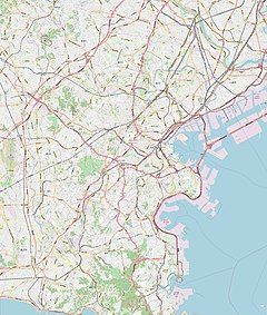
Maioka Station (舞岡駅, Maioka-eki) is an underground metro station located in Totsuka-ku, Yokohama, Kanagawa, Japan operated by the Yokohama Municipal Subway’s Blue Line (Line 1). It is 9.0 kilometers from the terminus of the Blue Line at Shōnandai Station.
Lines
[edit]Station layout
[edit]Maioka Station has a two underground opposed side platforms.
Platforms
[edit]| 1 | ■ Blue Line (Yokohama) | Shōnandai |
| 2 | ■ Blue Line (Yokohama) | Totsuka, Kamiōoka, Kannai, Yokohama, Azamino |
-
Ticket gates
-
Platform
History
[edit]Maioka Station was opened on 14 March 1985, originally as a terminal station of the Blue Line. It became an intermediate station when the line was extended to Totsuka on 24 May 1987. Platform screen doors were installed in September of 2007.
References
[edit]- Harris, Ken and Clarke, Jackie. Jane's World Railways 2008-2009. Jane's Information Group (2008). ISBN 0-7106-2861-7
Wikimedia Commons has media related to Maioka Station.
External links
[edit]- Maioka Station (Blue Line) (in Japanese)


