Maha Chana Chai district
Maha Chana Chai
มหาชนะชัย | |
|---|---|
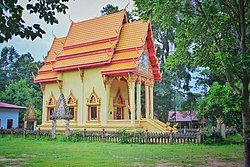
 Ordination hall of local temple Wat Tri Suwannaram | |
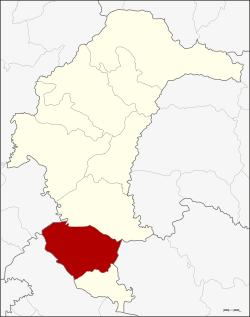
 District location in Yasothon province | |
| Coordinates: 15°31′57″N 104°14′33″E / 15.53250°N 104.24250°E | |
| Country | Thailand |
| Province | Yasothon |
| Seat | Fa Yat |
| Area | |
• Total | 455.27 km2 (175.78 sq mi) |
| Population (2005) | |
• Total | 58,670 |
| • Density | 128.9/km2 (334/sq mi) |
| Time zone | UTC+7 (ICT) |
| Postal code | 35130 |
| Geocode | 3506 |
Maha Chana Chai (Thai: มหาชนะชัย, pronounced [mā.hǎː tɕʰā.náʔ tɕʰāj]; Northeastern Thai: มหาชนะชัย, pronounced [mā.hǎː sā.nàʔ sa᷇j]) is a district of Yasothon province in northeastern Thailand.
History
[edit]In 1859, Prince Thao Puttakhamphun (ท้าวปุตตะคำพูน ราชบุตร) founded a new city in the vicinity of the village of Woen Chai (บ้านเวินชัย) beside the Chi River, which he named Mueang (city of) Han Chai Cham Na (เมืองหันชัยชำนะ translation unknown.) In 1863, King Rama IV renamed the town Mueang Maha Chana Chai ('triumphant victory')[1]
The town became a district (amphoe) of Ubon Ratchathani province in 1909, and on 24 April 1917 its name was changed to Fa Yat District (อำเภอฟ้าหยาด), because the district office was in Fa Yat village, Fa Yat sub-district.[2] On 7 April 1939, the name reverted to Maha Chana Chai District.[3]
On 1 March 1972, when Yasothon Province was established, Maha Chana Chai was one of six districts assigned to the new province.
Geography
[edit]Neighboring districts are (from the north clockwise): Kham Khuean Kaeo of Yasothon Province; Khueang Nai of Ubon Ratchathani province; Kho Wang of Yasothon Province; Rasi Salai, Sila Lat of Sisaket province' and Phanom Phrai of Roi Et province.
Administration
[edit]The district is divided into 10 sub-districts (tambons), with 103 villages (mubans).
|
|
Schools
[edit]- Ban Huadong School (โรงเรียนบ้านหัวดง)
Secondary schools
[edit]- Maha Chana Chai Witthayakhom School (โรงเรียนมหาชนะชัยวิทยาคม)
- Trakun Prathueang Witthayakhom School (โรงเรียนตระกูลประเทืองวิทยาคม)
Colleges
[edit]- Yasothon College of Agriculture and Technology (วิทยาลัยเกษตรและเทคโนโลยียโสธร)
References
[edit]- ^ ประวัติอำเภอมหาชนะชัย (in Thai). เทศบาลตำบลฟ้าหยาด. Archived from the original on July 10, 2011. Retrieved October 16, 2011.
ท้าวปุตตะคำพูน ราชบุตรไปจัดตั้งเมืองใหม่ ณ บริเวณบ้านเวินชัย ซึ่งตั้งอยู่ริมฝั่งแม่น้ำชี เมื่อปี พ.ศ. 2402
- ^ ประกาศกระทรวงมหาดไทย เรื่อง เปลี่ยนชื่ออำเภอ (PDF). Royal Gazette (in Thai). 34 (ก): 40–68. April 29, 1917. Archived from the original (PDF) on November 7, 2011.
- ^ พระราชกฤษฎีกาเปลี่ยนนามอำเภอ กิ่งอำเภอ และตำบลบางแห่ง พุทธศักราช ๒๔๘๒ (PDF). Royal Gazette (in Thai). 56 (ก): 354–364. April 17, 1939. Archived from the original (PDF) on February 19, 2009.
