Magyarpolány
Appearance
You can help expand this article with text translated from the corresponding article in German. Click [show] for important translation instructions.
|
Magyarpolány | |
|---|---|
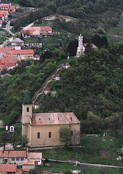
 Aerial photography of Magyarpolány | |
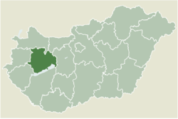
 Location of Veszprém county in Hungary | |
| Coordinates: 47°10′13″N 17°32′48″E / 47.17024°N 17.54655°E | |
| Country | |
| County | Veszprém |
| Area | |
• Total | 26.97 km2 (10.41 sq mi) |
| Population (2004) | |
• Total | 1,198 |
| • Density | 44.41/km2 (115.0/sq mi) |
| Time zone | UTC+1 (CET) |
| • Summer (DST) | UTC+2 (CEST) |
| Postal code | 8449 |
| Area code | 88 |
Magyarpolány is a village in Veszprém county, Hungary.[1]
References
[edit]- ^ "Magyarpolány | Schwaben.hu". schwaben.hu (in Hungarian). Retrieved 2024-01-24.
External links
[edit]


