Madavoor-Pallickal
This article may be confusing or unclear to readers. (May 2021) |
Madavoor-Pallickal
Madavoor | |
|---|---|
village | |
| Coordinates: 8°48′21″N 76°49′48″E / 8.8058°N 76.8301°E | |
| Country | |
| State | Kerala |
| District | Thiruvananthapuram |
| Taluk | Varkala |
| Government | |
| • Body | Gram panchayat |
| Population (2008) | |
• Total | 31,050 |
| Languages | |
| • Official | Malayalam, English |
| Time zone | UTC+5:30 (IST) |
| PIN | 695602[1] |
| Telephone code | 0470 |
| Vehicle registration | KL-81 |
| Nearest city | Varkala |
| Assembly constituency | Varkala |
| Civic agency | Madvoor |
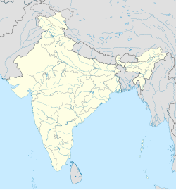
Madavoor is a village in the Varkala Taluk of the Trivandrum district in the state of Kerala, India. It is situated 18 km east of Varkala.[2]
Demographics
[edit]As of 2001[update] India census, Madavoor had a population of 20,855 with 9,932 males and 10,923 females.[2]
It is located on the road connecting Kilimanoor and Nilamel (mc road) Parippally (National Highway)
Madavoor belongs to the South Kerala Division. It is located 45 km north of district headquarters Thiruvananthapuram.
Parippally, Pazhayakunnummel, Kilimanoor, Nagaroor, Chemmaruthy are the nearby villages. Nearby cities include Paravoor, Varkala, Attingal, and Kollam.
Madavoor is surrounded by Chadayamangalam Block to the east, Varkala Block to the south, Ithikkara Block to the west, and Chirayinkeezhu Block to the south.
Agriculture is the main profession in the village.
Gramapanchayat
[edit]The local self-government of Madavoor consists of 15 elected members. The office is located at Mavinmoodu, near N.S.S.H.S. Madavoor.
References
[edit]- ^ "India Post :Pincode Search". Archived from the original on 20 May 2012. Retrieved 16 December 2008.
- ^ a b "Census of India : Villages with population 5000 & above". Registrar General & Census Commissioner, India. Archived from the original on 8 December 2008. Retrieved 10 December 2008.


