Longueira / Almograve
Appearance
Longueira / Almograve | |
|---|---|
 | |
| Coordinates: 37°39′07″N 8°47′35″W / 37.652°N 8.793°W | |
| Country | |
| Region | Alentejo |
| Intermunic. comm. | Alentejo Litoral |
| District | Beja |
| Municipality | Odemira |
| Area | |
• Total | 91.69 km2 (35.40 sq mi) |
| Population (2021) | |
• Total | 2,238 |
| • Density | 24/km2 (63/sq mi) |
| Time zone | UTC+00:00 (WET) |
| • Summer (DST) | UTC+01:00 (WEST) |
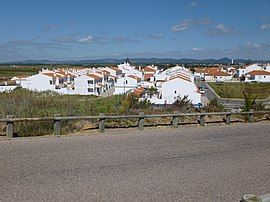
Longueira / Almograve is a Portuguese parish in the municipality of Odemira. As of 2021, the parish has an estimated 2,338 inhabitants in an area of 91.69 km2.[1] With the 2021 census, Longueira / Almograve became the highest growing civil parish in Portugal, with an additional 72.4% from 2011.[2] It was created on June 12, 2001, from the parish of São Salvador.
References
[edit]- ^ "Áreas das freguesias, concelhos, distritos e país". Archived from the original on 2018-11-05. Retrieved 2018-11-05.
- ^ "Resultados Preliminares". censos.ine.pt. Retrieved 6 September 2021.

