Les Pommerats
Appearance
Les Pommerats | |
|---|---|
| Coordinates: 47°16′N 06°59′E / 47.267°N 6.983°E | |
| Country | Switzerland |
| Canton | Jura |
| District | Franches-Montagnes |
| Area | |
• Total | 11.51 km2 (4.44 sq mi) |
| Elevation | 899 m (2,949 ft) |
| Population (2007-01-01)[1] | |
• Total | 247 |
| • Density | 21/km2 (56/sq mi) |
| Time zone | UTC+01:00 (Central European Time) |
| • Summer (DST) | UTC+02:00 (Central European Summer Time) |
| Postal code(s) | 2353 |
| SFOS number | 524 |
| ISO 3166 code | CH-JU |
| Surrounded by | Goumois, Muriaux, Saignelégier, Le Bémont, Les Enfers, Soubey, Indevillers(F) |
| Website | SFSO statistics |
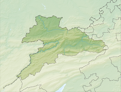
Les Pommerats (French pronunciation: [le pɔmʁa]) is a municipality in the district of Franches-Montagnes in the canton of Jura in Switzerland. On 1 January 2009, the formerly independent municipalities of Goumois and Les Pommerats merged into Saignelégier.[2]
References
[edit]- ^ "Population résidante moyenne selon les communes". Federal Statistical Office.
- ^ Amtliches Gemeindeverzeichnis der Schweiz published by the Swiss Federal Statistical Office (in German) accessed 14 January 2010


