Lee Stocking Island
Appearance
| Geography | |
|---|---|
| Location | Atlantic Ocean |
| Coordinates | 23°46′20″N 76°05′59″W / 23.7721°N 76.0998°W |
| Archipelago | Lucayan Archipelago |
| Administration | |
| Additional information | |
| Time zone | |
| • Summer (DST) | |
| ISO code | BS-EX |
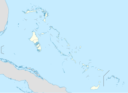
Lee Stocking Island is an island in the Bahamas, located in the district of Exuma.
The island was host to a marine research facility from 1984 to 2012, which was connected to NOAA.[1] Stromatolites are found offshore of the island.[2][3]
A map of 1823 shows it was actually named, “Leeward Stocking Island”. In the days before Google Earth, map makers drew it as a stocking. Upwind towards the predominant South East Tradewinds was “Windward Stocking”. Later in 1898, the name was noted as “Leonard Stocking Island”.
References
[edit]- ^ "Our History". Perry Institute for Marine Science. Retrieved 6 January 2019.
- ^ "Stromatolites of Lee Stocking Island". BBC. Retrieved 6 January 2019.
- ^ Dill, R.F.; Kendall, C.G.St.C.; Shinn, E.A. (1989). Giant Subtidal Stromatolites and Related Sedimentary Features: field trip guidebook T373 (PDF). Washington, D.C.: American Geophysical Union. p. 1. ISBN 0875906494. OCLC 1049421426.

