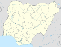
Lamurde
Lamurde | |
|---|---|
LGA and town | |
| Nickname: Bachama | |
| Coordinates: 9°36′N 11°47′E / 9.600°N 11.783°E | |
| Country | |
| State | Adamawa State |
| Government | |
| • Local Government Chairman | Bulus Daniel (PDP)[1] |
| Area | |
• Total | 3,507 sq mi (9,083 km2) |
| Population (2022)[2] | |
• Total | 571,600 |
| • Density | 160/sq mi (63/km2) |
| Time zone | UTC+1 (WAT) |
 | |
Lamurde is a town and Local Government Area of Adamawa State, Nigeria inhabited predominantly by the Bwatiye (Bachama) people.
History
[edit]The Lamurde Local Government was established on December 14, 1990, from the local government of Numan. Numerous local government areas in the state shares borders with it, including Taraba state to the west, Guyuk and Shelleng local government areas to the east, Gombe State to the north, and Numan local government to the south. The local government area is 2098 square kilometers in size, and it is located roughly between latitudes 10 24" west and 12 45" east, as well as 90 39" north and 90 11" south. The local government's population was 511.252 according to the 2006 census. Bwatiye (Bachama and Bata), Chobbo, Kwah, Waja, Mwana, Dadiya, Jenjo, Hausa, and Fulani are the ethnic groups present in the region.[3]
Climate
[edit]The rainy season in Lamurde is hot, humid, and overcast, whereas the dry season is hot and partially cloudy. Throughout the year, the temperature normally ranges from 16 °C (61 °F) to 38 °C (101 °F), with temperatures rarely falling below 13 °C (56 °F) or rising over 42 °C (107 °F).[4] [5]
Air pollution
[edit]Air pollution, including dust from vehicles, poses a significant threat to public health, as it can be harmful and inhaled into the deepest parts of the lung.[6][7][8]
References
[edit]- ^ "Adamawa LGA Elections: PDP Wins All 21 Chairmanship Seats". The Sun Nigeria. Retrieved 2024-12-23.
- ^ "Lamurda (Local Government Area, Nigeria) - Population Statistics, Charts, Map and Location". www.citypopulation.de. Retrieved 2024-02-05.
- ^ Murreyseth (2016-02-23). "Historical Background of the People of Lamurde Local Government Founding ancestors Zaro white and Zaro black". Gyawana Community. Retrieved 2023-10-03.
- ^ "Lamurde Climate, Weather By Month, Average Temperature (Nigeria) - Weather Spark". weatherspark.com. Retrieved 2023-07-12.
- ^ "Weather Lamurde". meteoblue. 2023-08-05. Retrieved 2023-08-05.
- ^ "Air Quality & Pollen Forecast for Lamurde". meteoblue. Retrieved 2023-09-24.
- ^ "Lamurde Air Quality Index (AQI) and Nigeria Air Pollution | IQAir". www.iqair.com. 2023-09-24. Retrieved 2023-09-24.
- ^ "Lamurde kofa, AD Weather Forecast and Conditions - The Weather Channel | Weather.com". The Weather Channel. Retrieved 2023-09-24.

