Kyanjin Ri
Kyanjin Ri
क्यान्जिन री | |
|---|---|
 | |
| Coordinates: 28°12′46″N 85°36′00″E / 28.21278°N 85.60000°E | |
| Country | |
| Province | Bagmati Province |
| District | Rasuwa District |
| Elevation | 4,773 m (15,659 ft) |
| Time zone | UTC+5:45 (Nepal Time) |
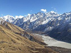
Kyanjin Ri is a popular viewpoint to see the Langtang Himalayan range. It is one of the best viewpoints which is a 2-3 hour hike from the Kyanjin Gompa Village. Kyanjin Gompa village is a small settlement with some Tamang Ethnic groups they follow Buddhism and they have a Gompa There. The viewpoints allow you to enjoy the 360-degree panoramic view of the Langtang Himalayan range.
Kyanjin Ri is the ultimate destination for the hikers who do the Langtang Trek
The Kyanjin ri hike can be done from Kyanjin Gompa village which is located in the Langtang valley Langtang and is also part of the Langtang National Park.Langtang National Park. The 7-9 days trek can be ideal for the trekkers it starts from Kathmandu and ends at Kathmandu and trekkers can see the stunning views of peaks like Langtang Lirung Langtang Lirung, Langtang Ri 7,205 m (23,638 ft), Changbu 6,781 m (22,247 ft), Gangchenpo 6,387 m (20,955 ft), Yansa Tsenji 6,690 m (21,950 ft) and many other peak.
List of the peaks can be seen from Kyanjin Ri
[edit]Hikers can enjoy the stunning views of the Langtang Himalayan peaks. The peaks which you can see from the Kyanjin Ri are listed below:[1]
| Peak | elevation |
|---|---|
| Langtang Lirung | 7,234 m (23,734 ft) |
| Langtang Ri | 7,205 m (23,638 ft) |
| Dorje Lakpa | 6,966 m (22,854 ft) |
| Loenpo Gang | 6,979 m (22,897 ft) |
| Changbu | 6,781 m (22,247 ft) |
| Yansa Tsenji | 6,690 m (21,950 ft) |
| Kyunga Ri | 6,601 m (21,657 ft) |
| Dogpache | 6,562 m (21,529 ft) |
| Langshisha Ri | 6,427 m (21,086 ft) |
| Gangchenpo | 6,387 m (20,955 ft) |
| Morimoto | 6,150 m (20,180 ft) |
| Tsogaka | 5,846 m (19,180 ft) |
| Yala Peak | 5,520 m (18,110 ft) |
References
[edit]External links
[edit]


