Kozani National Airport
Appearance
(Redirected from Kozani National Airport "Filippos")
Kozani National Airport Filippos Κρατικός Αερολιμένας Κοζάνης "Φίλιππος" | |||||||||||
|---|---|---|---|---|---|---|---|---|---|---|---|
| Summary | |||||||||||
| Airport type | Public | ||||||||||
| Operator | HCAA | ||||||||||
| Location | Kozani | ||||||||||
| Elevation AMSL | 2,059 ft / 628 m | ||||||||||
| Coordinates | 40°17′10″N 21°50′27″E / 40.28611°N 21.84083°E | ||||||||||
| Map | |||||||||||
 | |||||||||||
| Runways | |||||||||||
| |||||||||||
| Statistics (2018) | |||||||||||
| |||||||||||
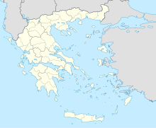
Kozani National Airport "Filippos" (Greek: Κρατικός Αερολιμένας Κοζάνης "Φίλιππος") (IATA: KZI, ICAO: LGKZ) is located 4 km (2.5 mi) southeast of the Greek city of Kozani. It started operations in the 1950s. Kozanis' and Kastorias' airports are the only two public airports in the region of Western Macedonia, Greece.
Airlines and destinations
[edit]The following airlines operate regular scheduled and charter flights at Kozani National Airport:
| Airlines | Destinations |
|---|---|
| Sky Express | Athens,[3] Kastoria[3] |
Statistics
[edit]Graphs are unavailable due to technical issues. Updates on reimplementing the Graph extension, which will be known as the Chart extension, can be found on Phabricator and on MediaWiki.org. |
Annual passenger traffic at KZI airport.
See Wikidata query.
See also
[edit]References
[edit]- ^ "KOZANI AIRPORT "FILIPPOS"". ypa.gr. Retrieved 8 June 2016.
- ^ "Kozani Airport". Archived from the original on 2013-07-02. Retrieved 2006-01-31.
- ^ a b "LIST OF PUBLIC SERVICE OBLIGATIONS" (PDF). Aeroroutes.com. 11 March 2024. Retrieved 4 January 2025.
External links
[edit]

