Košťany nad Turcom
Košťany nad Turcom | |
|---|---|
Village | |
 | |
| Coordinates: 49°02′N 18°54′E / 49.033°N 18.900°E | |
| Country | Slovakia |
| Region | Žilina |
| District | Martin |
| First mentioned | 1332 |
| Area | |
• Total | 6.43[2] km2 (2.48[2] sq mi) |
| Elevation | 415[3] m (1,362[3] ft) |
| Population (2021) | |
• Total | 1,382[1] |
| Postal code | 038 41[3] |
| Area code | +421 43[3] |
| Car plate | MT |
| Website | www.kostanynadturcom.sk |
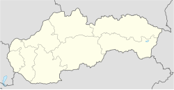
Košťany nad Turcom (Hungarian: Kostyán) is a village and municipality in Martin District, in Turiec territory, and in Žilina Region of northern Slovakia.
History
[edit]In historical records of the village, a dwelling 'villa Coschan' was first mentioned in year 1323. Before the establishment of independent Czechoslovakia in 1918, it was part of Turóc County within the Kingdom of Hungary. From 1939 to 1945, it was part of the Slovak Republic.
Main occupation of locals has been focused on agriculture and seasonal food-harvests that were produced for various landlords who resided in Košťany nad Turcom ever since.
Abandoning feudal servitude Feudalism in 1848 and declaring basic freedom rights led residents to develop more commercial activities such crafts and trade. In the 20th century, especially during communist regime Joint agriculture and farming Collective farming remained major daily bread for locals.
Early years of new millennium have seen legislative support towards larger businesses, which led to few industrial factories growth in Košťany nad Turcom. In fact, most residents commute to Martin Martin, Slovakia, major workhub in Turiec.
Geography
[edit]The village settlement lies at an altitude of 410 metres and covers an area of 6.436 km². It has a population of about 1,095 people. It lies on Turiec river, Košťany nad Turcom as the whole Turiec basin (Turčianska kotlina) are surrounded by mountain range Greater Fatra (Veľká Fatra) on east-north and by mountain range Lesser Fatra (Malá Fatra) on west.
Places of interest
[edit]Košťany nad Turcom as other allied villages in Turiec lies in picturesque scenery. Near mountain ranges offer abundance of outdoor opportunities; from trekking or bouldering in summer, to cross-country skiing or kiteboarding in winter. Local castle ruins sightseeing, geocaching, mountain-biking etc.
Turiec region is also rich in precious mineral water sources, or you can visit few of the left sheep-farming chalets called 'salaš' scattered on the hill tops. If you are not that lucky to find them, then try ruins of ancient castles List of castles in Slovakia in few neighbor villages.
On the top of landscape beauty, 3 km north of the village sits forest area 'Jahodnícke Háje', with hidden 'skanzen'. Skanzen is another name in Slovakia for an open-air museum. From all open-air museums in Slovakia, Jahodnícke háje (or Martin) skanzen is the largest one and it's worth to pay a visit especially during Christian holidays (recommended are Christmas and Easter..) as presentations of life from ancient times, markets with historical items, marches, and dances occur regularly. Dwelling houses, barns, church, and even taverna have been carefully replaced from various parts of Slovakian rural areas, brought to skanzen grounds and rebuilt in original style. http://www.skanzenmartin.sk/ (see map in external links for directions)
Gallery
[edit]-
Belianka River, peaks of Veľká Fatra mountain range in behind
-
View of Malá Fatra mountain range from neighbouring village Pribovce
-
Košťany nad Turcom
-
Church in Skanzen Martin
-
River Turiec flowing through Košťany nad Turcom
-
Eastern view of Turiec basin and Veľká Fatra in distance
-
Street view
Genealogical resources
[edit]The records for genealogical research are available at the state archive "Statny Archiv in Bytca, Slovakia"
- Roman Catholic church records (births/marriages/deaths): 1773-1941 (parish B)
- Lutheran church records (births/marriages/deaths): 1783-1928 (parish B)
See also
[edit]References
[edit]- ^ "Počet obyvateľov podľa pohlavia - obce (ročne)". www.statistics.sk (in Slovak). Statistical Office of the Slovak Republic. 2022-03-31. Retrieved 2022-03-31.
- ^ a b "Hustota obyvateľstva - obce [om7014rr_ukaz: Rozloha (Štvorcový meter)]". www.statistics.sk (in Slovak). Statistical Office of the Slovak Republic. 2022-03-31. Retrieved 2022-03-31.
- ^ a b c d "Základná charakteristika". www.statistics.sk (in Slovak). Statistical Office of the Slovak Republic. 2015-04-17. Retrieved 2022-03-31.
- ^ a b "Hustota obyvateľstva - obce". www.statistics.sk (in Slovak). Statistical Office of the Slovak Republic. 2022-03-31. Retrieved 2022-03-31.
External links
[edit]- council website: http://www.kostanynadturcom.sk
- local recommendations by Tupalo: http://tupalo.com/en/search?q=martin%2C+slovakia&commit=Search
- flag and coat of arms: http://www.crwflags.com/fotw/flags/sk-mt-kt.html#kt
- detailed map: http://mapper.acme.com/?ll=49.03832,18.92498&z=12&t=M&marker0=49.03333%2C18.90000%2CKo%C5%A1%C5%A5any%20nad%20Turcom&marker1=49.03832%2C18.92498%2C3.2%20km%20S%20of%20Martin
- slovak web about hiking around Turiec: http://hiking.sk/hk/li/-mala_fatra.html
- images on Flickr: https://www.flickr.com/map/?fLat=49.033333&fLon=18.9&zl=5
- images on Panoramio: https://web.archive.org/web/20141219052551/http://www.panoramio.com/map#lt=49.028035&ln=18.905021&z=2&k=1&a=1&tab=1#lt=49.028035&ln=18.905021&z=2&k=1&a=1&tab=1
- Surnames of living people in Kostany nad Turcom


