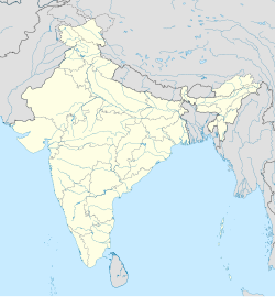
Katghara, Deoria
Appearance
Katghara, Deoria
Katghara | |
|---|---|
village | |
| Coordinates: 26°14′35.77″N 84°2′23.37″E / 26.2432694°N 84.0398250°E | |
| Country | |
| State | Uttar Pradesh |
| District | Deoria |
| Population (2001) | |
• Total | 1,221 |
| Languages | |
| • Official | Hindi |
| Time zone | UTC+5:30 (IST) |
Katghara is a village in the Deoria district in the state of Uttar Pradesh, India.
Geography
[edit]Katghara falls under the Bhatpar Rani block. It has its own gram panchayat.
Demographics
[edit]As of the 2001 Indian census,[1] Kathaghara had a population of 1,221. Males constitute 47% of the population and females 53%.
Cities, towns, and neighborhoods
[edit]The nearest place for shopping is Aktahi. The nearest town is Bhatpar Rani.
Schools
[edit]Katghara village has primary school[clarification needed] funded by the state government. It also has a privately owned middle school (up to class 10). There are schools in Bahiyari and Sohanpur for 10+2. The only option for graduation is Madan Mohan Malviya University situated at Bhatpar Rani.
References
[edit]- ^ "Census of India 2001: Data from the 2001 Census, including cities, villages and towns (Provisional)". Census Commission of India. Archived from the original on 16 June 2004. Retrieved 1 November 2008.
http://www.maavooru.org/Place.aspx?PID=588067


