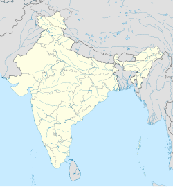
Kalapani, Bhopal
Appearance
Kalapani | |
|---|---|
village | |
| Coordinates: 23°05′27″N 77°23′08″E / 23.090863°N 77.385645°E | |
| Country | India |
| State | Madhya Pradesh |
| District | Bhopal |
| Tehsil | Huzur |
| Population (2011) | |
• Total | 2,725 |
| Time zone | UTC+5:30 (IST) |
| ISO 3166 code | MP-IN |
| Census code | 482531 |
Kalapani is a village in the Bhopal district of Madhya Pradesh, India.[1] It is located in the Huzur tehsil, beside Kolar road. The Kathotiya hiking area is located near Kalapani.
Demographics
[edit]According to the 2011 census of India, Kalapani has 567 households. The effective literacy rate (i.e. the literacy rate of population excluding children aged 6 and below) is 46.82%.[2]
| Total | Male | Female | |
|---|---|---|---|
| Population | 2725 | 1446 | 1279 |
| Children aged below 6 years | 525 | 277 | 248 |
| Scheduled caste | 307 | 168 | 139 |
| Scheduled tribe | 767 | 389 | 378 |
| Literates | 1030 | 642 | 388 |
| Workers (all) | 1201 | 753 | 448 |
| Main workers (total) | 921 | 597 | 324 |
| Main workers: Cultivators | 255 | 145 | 110 |
| Main workers: Agricultural labourers | 103 | 57 | 46 |
| Main workers: Household industry workers | 12 | 10 | 2 |
| Main workers: Other | 551 | 385 | 166 |
| Marginal workers (total) | 280 | 156 | 124 |
| Marginal workers: Cultivators | 2 | 0 | 2 |
| Marginal workers: Agricultural labourers | 209 | 130 | 79 |
| Marginal workers: Household industry workers | 2 | 1 | 1 |
| Marginal workers: Others | 67 | 25 | 42 |
| Non-workers | 1524 | 693 | 831 |
References
[edit]- ^ Integrated Management Information System (IMIS)
- ^ a b "District Census Handbook - Bhopal" (PDF). 2011 Census of India. Directorate of Census Operations, Madhya Pradesh. Retrieved 20 July 2015.


