Kōnan Airport
Kōnan Airport 岡南飛行場 Kōnan Hikōjō | |||||||||||
|---|---|---|---|---|---|---|---|---|---|---|---|
 | |||||||||||
| Summary | |||||||||||
| Airport type | Public | ||||||||||
| Operator | Okayama Prefecture | ||||||||||
| Location | Okayama, Japan | ||||||||||
| Opened | 13 October 1962 | ||||||||||
| Elevation AMSL | 0 ft / 0 m | ||||||||||
| Coordinates | 34°35′29″N 133°56′00″E / 34.59139°N 133.93333°E | ||||||||||
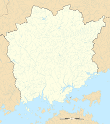
| Map | |||||||||||
 | |||||||||||
| Runways | |||||||||||
| |||||||||||
Kōnan Airport (岡南飛行場, Kōnan Hikōjō) (ICAO: RJBK) is a public aerodrome located about eight kilometres (5.0 mi) south of Okayama Station in Minami-ku, Okayama, Japan.
History
[edit]The airport opened on October 13, 1962, as Okayama Airport. It had scheduled service by All Nippon Airways (Tokyo Haneda) and Toa Domestic Airlines (Matsuyama and Miyazaki); however, the runway was too short to accommodate jet service, and the largest aircraft that could reliably use the airport was the NAMC YS-11.
On March 11, 1988, concurrently with the opening of new Okayama Airport, Konan became an airport exclusively for small planes under the present name.[2]
A ten-seat Cessna jet overshot the runway at the airport on June 10, 2015, landing in a nearby lake.[3]
Ground transportation
[edit]Bus
[edit]| No[4] | Via | Destination | Company | Note |
|---|---|---|---|---|
| 41 | Urayasuguchi・Japan Red Cross Okayama Hospital・Okayama University Hospital・Okayama City Hall | Okayama Station | Okaden Bus | |
| 62 | Urayasuguchi・Seikibashi Station・Higashi-chūōchō Station・Daiunji-mae Station・Shin-Saidaijichōsuji Station・Tenmanya Bus Terminal・Yanagawa Station (Okayama)・Nishigawa-ryokudōkōen Station | Okayama Station | Okaden Bus |
References
[edit]- ^ AIS Japan Archived 2016-05-17 at the Portuguese Web Archive
- ^ Kōnan Airport Administration Office (December 14, 2009). 飛行場の概要 (in Japanese). Retrieved February 26, 2011.
- ^ "Plane overshoots runway, goes into lake in Okayama". Japan Today. 11 June 2015. Retrieved 12 June 2015.
- ^ "P4" (PDF). Okadenbus (in Japanese).


