Huzurabad
This article needs additional citations for verification. (May 2022) |
Huzurabad | |
|---|---|
 | |
| Coordinates: 18°12′N 79°25′E / 18.20°N 79.42°E | |
| Country | India |
| State | Telangana |
| District | Karimnagar |
| Government | |
| • Body | Municipal council |
| • MLA | Kaushik Reddy |
| • MP | Bandi Sanjay Kumar (BJP) |
| Area | |
• Total | 32.24 km2 (12.45 sq mi) |
| Elevation | 271 m (889 ft) |
| Population (2011)[3] | |
• Total | 37,656 |
| • Density | 1,200/km2 (3,000/sq mi) |
| Languages | |
| • Official | Telugu, Urdu |
| Time zone | UTC+5:30 (IST) |
| PIN | 505468 |
| Telephone code | 91-8727 |
| Vehicle registration | TG-02 |
| Lok Sabha | Karimnagar |
| Assembly constituency | Huzurabad |
| Website | www |
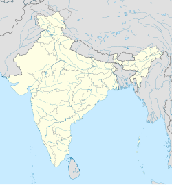
Huzurabad is a town in the Huzurabad mandal of Karimnagar district in the Indian state of Telangana. It is a municipality in the district. It is located about 41 kilometres (25 mi) from Karimnagar and 38 kilometres (24 mi) from Warangal.
Huzurabad is an educational hub and has general hospital services for nearby towns and villages. The Government High School and Government Junior College have playgrounds and interstate competitions are often held in this town.
The best known landmarks in the town are Super Bazaar Road, Old Super Bazaar (jewellery bazaar), DCMS Complex, Hanuman Temple, Karimnagar Road Petrol Bunk, Warangal Road Petrol Bunk, Nataraj Theatre, Annapurna Theatre, the bus depot, K C Camp, Ranganayakula Gutta, Patimedhi Anjaneya Swami Temple and the Government Hospital.
Model Cheruvu is the biggest Cheruvu in Huzurabad town and is going to become a reservoir.[4]
Geography
[edit]Huzurabad is at 18°12′N 79°25′E / 18.20°N 79.42°E.[5] It has an average elevation of 271 metres (889 ft).[2]
Demographics
[edit]In the 2011 census, Huzurabad had a population of 37,665 (19,208 males and 18,457 females — a sex ratio of 961 females per 1000 males). 3,140 children were in the age group of 0–6 years. The average literacy rate was 75.72% with 26,141 literates.[3]
Government and politics
[edit]Huzurabad Nagar Panchayat was constituted in 2011 and has 20 election wards. The jurisdiction of the civic body is spread over an area of 32.24 km2 (12.45 sq mi).[1] In 2019, it became a municipality.
Transport
[edit]Huzurabad is well connected by road. National Highway 563 passes through this town. State run TSRTC buses operates from Huzurabad bus depot to various cities and towns of the state and to surrounding rural areas.[6]
Rail
[edit]Huzurabad will be part of the proposed Karimnagar-Hasanparthy line. The line was sanctioned for final location survey in September 2023 by the South Central Railways.[7]
Notable people
[edit]The former prime minister, P. V. Narasimha Rao, studied here in the Government Boys' High School.[citation needed]
References
[edit]- ^ a b "Urban Local Body Information" (PDF). Directorate of Town and Country Planning. Government of Telangana. Archived from the original (PDF) on 15 June 2016. Retrieved 28 June 2016.
- ^ a b "Elevation for Huzurabad". Veloroutes. Retrieved 28 April 2014.
- ^ a b "Census 2011". The Registrar General & Census Commissioner, India. Retrieved 26 July 2014.
- ^ "Revenue Divisions and Mandals". National Informatics Centre. Retrieved 20 August 2015.
- ^ Maps, Weather, and Airports for Huzurabad, India
- ^ "Depot Name". APSRTC. Archived from the original on 15 March 2015. Retrieved 28 April 2015.
- ^ "South Central Railway".


