Hulata
Appearance
Hulata
חוּלָתָה | |
|---|---|
 | |
| Coordinates: 33°3′6.11″N 35°36′34.91″E / 33.0516972°N 35.6096972°E | |
| Country | Israel |
| District | Northern |
| Council | Upper Galilee |
| Affiliation | Kibbutz Movement |
| Founded | 1937 |
| Founded by | Makhnot HaOlim members |
| Population (2022)[1] | 754 |
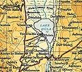
Hulata (Hebrew: חוּלָתָה) is a kibbutz in northern Israel. Located in the Hula Valley, it falls under the jurisdiction of Upper Galilee Regional Council. In 2022 it had a population of 754.[1]
History
[edit]The kibbutz was established in 1937 as a fishing village by a gar'in of HaMahanot HaOlim youth group members. It was named for its location in the Hula Valley. After the draining of the Hula swamps, the residents began working in agriculture.[2]
The documentary film Kibbutz traces the stages of grieving and disillusionment that followed Hulata's economic collapse and privatization.[3]
Hulata is a pluralistic kibbutz that accepts members from all backgrounds, both religiously observant and not.[4]
Gallery
[edit]-
Young women in Hulata weaving mats in 1940
-
Hulata in 1945
-
Spice market at Hulata in 2016
-
Hulata. Survey of Palestine. 1945. Scale 1:250,000
-
Former communal dining room
-
Members of the kibbutz, bringing in reeds cut on the northern shore of Lake Hula in 1940
Notable residents
[edit]- Tal Russo
- Mike Schwartz (born 1949), American-Israeli basketball player and coach
- Iftach Spector
References
[edit]- ^ a b "Regional Statistics". Israel Central Bureau of Statistics. Retrieved 21 March 2024.
- ^ The good life on a kibbutz, Haaretz
- ^ Kibbutz: Documentary
- ^ The good life on a kibbutz, Haaretz


