Heiligensee station
| Hp | |||||||||||
 Entrance | |||||||||||
| General information | |||||||||||
| Location | Heiligensee, Reinickendorf, Berlin Germany | ||||||||||
| Line(s) | Kremmen Railway ( | ||||||||||
| Construction | |||||||||||
| Architect | Hugo Röttcher | ||||||||||
| Other information | |||||||||||
| Station code | n/a | ||||||||||
| DS100 code | BHLS | ||||||||||
| Category | 4 | ||||||||||
| Fare zone | VBB: Berlin B/5656[1] | ||||||||||
| History | |||||||||||
| Opened | 1 October 1893 (freight only) 1 May 1897 15 December 1998 | ||||||||||
| Closed | 9 January 1984 | ||||||||||
| Electrified | 16 March 1927 | ||||||||||
| Previous names | 1893-1897 Güterverladestelle Heiligensee 1897-1938 Heiligensee | ||||||||||
| Key dates | |||||||||||
| 1925/1926 | current building erected | ||||||||||
| 1945, late April - 22 November | operation interrupted | ||||||||||
| Services | |||||||||||
| |||||||||||
 | |||||||||||
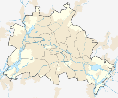
Heiligensee is a railway station in Heiligensee, a locality in the Reinickendorf borough of Berlin. It is served by the S-Bahn line S25.
History
[edit]With the construction of the Wall on 13 August 1961, the outbound traffic was interrupted and Heiligensee to the terminus on West Berlin territory. After the transfer of the S-Bahn traffic from the Reichsbahn to the Berlin public transport on 9 January 1984, the decommissioning of the Kremmener Bahn took place in Berlin.
Only after the fundamental renewal of the route Berlin Schönholz - Hennigsdorf (the railway embankment had been demolished in part for the construction of the A111), construction began on 20 July 1995. The station was reopened together with the reopened section between Tegel and Hennigsdorf on 15 December 1998.
References
[edit]- ^ "Der VBB-Tarif: Aufteilung des Verbundgebietes in Tarifwaben und Tarifbereiche" (PDF). Verkehrsbetrieb Potsdam. Verkehrsverbund Berlin-Brandenburg. 1 January 2017. Archived from the original (PDF) on 27 October 2020. Retrieved 25 November 2019.
52°37′28″N 13°13′46″E / 52.6244°N 13.2295°E


