Hassi R'Mel
Hassi R'Mel
Ḥasi Eṛṛmel | |
|---|---|
 | |
| Coordinates: 32°55′41″N 3°16′16″E / 32.928°N 3.271°E | |
| Country | |
| Province | Laghouat |
| District | Hassi R'Mel[1] |
| Area | |
• Total | 3,830 km2 (1,480 sq mi) |
| Population (2008[2]) | |
• Total | 22,133 |
| • Density | 5.8/km2 (15/sq mi) |
| Time zone | UTC+1 (West Africa Time) |
| Postal code | 03300 |
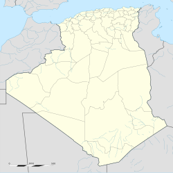
Hassi R'Mel (Arabic: حاسي الرمل, Berber language: Ḥasi Eṛṛmel) is a town in Algeria located near the 18th largest gas field worldwide. Hassi R'Mel is located in Laghouat Province 60 kilometres (37 mi) northwest of Ghardaïa. It is the capital of Hassi R'Mel District. Hassi R'Mel has an airport.
Hassi R'Mel is a hub for natural gas and oil pipelines running to coastal cities of Arzew, Algiers, and Skikda. The National Centre For Dispatching Gas is also the starting point for the Maghreb-Europe, Trans-Mediterranean, Medgaz and Galsi gas export pipelines supplying Southern Europe. The town is the planned final destination of the Trans-Saharan gas pipeline.
Hassi R'Mel is also home to an integrated solar combined cycle power station, the first of its kind in Algeria.[3]
Geology
[edit]The Hassi R'Mel gas field is a Triassic gas field discovered in 1956 with the HR-1 well and located in a Cretaceous anticline of the M'zab dorsal structure separating the Western Org Paleozoic basin to the west and the Oued Mya basin to the east.[4] Cambrian rhyolite forms the basement which is overlain by the Tassili Cambro-Ordovician sandstone group, a Siluro-Devonian shale and then Mesozoic sediments.[5] The A, B and C reservoir sandstones are Permo-Triassic with a total thickness of about 115 m and sealed by Late Triassic salt and shale.[6]
References
[edit]- ^ "Décret executif n° 91-306 du 24 août 1991 fixant la liste des communes animées par chaque chef de daïra. 03 - Wilaya de Laghouat" [List of municipalities animated by each District chief: 03 - Laghouat Province] (PDF) (in French). Journal officiel de la République Algérienne. 4 September 1991. p. 1294. Archived (PDF) from the original on 2019-10-25. Retrieved 2019-11-03.
- ^ "Wilaya de Laghouat: répartition de la population résidente des ménages ordinaires et collectifs, selon la commune de résidence et la dispersion" (PDF) (in French). Archived (PDF) from the original on 2023-06-07. Retrieved 2019-11-03.. Data from the 2008 General Population and Housing Census on the site of the NOS Algeria.
- ^ "Siemens to provide long-term service to first hybrid solar power plant in Algeria". Siemens Global Website. Amy Pempel. Archived from the original on 21 May 2024. Retrieved 30 November 2015.
- ^ Magloire, P. R., 1970, Triassic Gas Field of Hassi er R'Mel, Algeria, AAPG Memoir 14: Geology of Giant Petroleum Fields, Tulsa: AAPG, pp. 489-490.
- ^ Magloire, P. R., 1970, Triassic Gas Field of Hassi er R'Mel, Algeria, AAPG Memoir 14: Geology of Giant Petroleum Fields, Tulsa: AAPG, pp. 491-493.
- ^ Magloire, P. R., 1970, Triassic Gas Field of Hassi er R'Mel, Algeria, AAPG Memoir 14: Geology of Giant Petroleum Fields, Tulsa: AAPG, pp. 495-497.


