Guerquesalles
Appearance
Guerquesalles | |
|---|---|
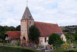
 Guerquesalles, Saint Germain Church. | |
| Coordinates: 48°54′26″N 0°12′29″E / 48.9072°N 0.2081°E | |
| Country | France |
| Region | Normandy |
| Department | Orne |
| Arrondissement | Mortagne-au-Perche |
| Canton | Vimoutiers |
| Intercommunality | Vallées d'Auge et du Merlerault |
| Government | |
| • Mayor (2020–2026) | Agnès Laigre[1] |
Area 1 | 8.66 km2 (3.34 sq mi) |
| Population (2022)[2] | 133 |
| • Density | 15/km2 (40/sq mi) |
| Time zone | UTC+01:00 (CET) |
| • Summer (DST) | UTC+02:00 (CEST) |
| INSEE/Postal code | 61198 /61120 |
| Elevation | 104–229 m (341–751 ft) (avg. 180 m or 590 ft) |
| 1 French Land Register data, which excludes lakes, ponds, glaciers > 1 km2 (0.386 sq mi or 247 acres) and river estuaries. | |
Guerquesalles (French pronunciation: [ɡɛʁkəsal] ⓘ) is a commune in the Orne department in north-western France.
Geography
[edit]The commune is made up of the following collection of villages and hamlets, Malvoue and Guerquesalles.[3]
The commune has two rivers running through it the Vie & the Viette in addition to four streams, the Fontaine de la Motte, the Fontaine de la Roche, the Moulin Neuf, plus the Valame.
Notable buildings and places
[edit]- Coteau du Champ-du-Noyer is a 1.36 hectare site is a protected area created in 2019 as part of the Natura 2000 initiative.[4]
National heritage sites
[edit]- Cocardière Manor is a 16th century manor house, classified as a Monument historique in 1929.[5]

See also
[edit]References
[edit]- ^ "Répertoire national des élus: les maires" (in French). data.gouv.fr, Plateforme ouverte des données publiques françaises. 13 September 2022.
- ^ "Populations de référence 2022" (in French). The National Institute of Statistics and Economic Studies. 19 December 2024.
- ^ a b "Google Maps". Google Maps.
- ^ "Autres sites naturels".
- ^ "Manoir de la Cocardière à Guerquesalles - PA00110816". monumentum.fr.
Wikimedia Commons has media related to Guerquesalles.
Wikivoyage has a travel guide for Guerquesalles.


