Giddaluru
Giddaluru | |
|---|---|
Town - Nagar Panchayat | |
| Coordinates: 15°22′35″N 78°55′30″E / 15.3764°N 78.9251°E | |
| Country | India |
| State | Andhra Pradesh |
| District | Prakasam |
| Mandal | Giddaluru |
| Government | |
| • Body | Giddalur Nagar Panchayat |
| Area | |
• Total | 31.57 km2 (12.19 sq mi) |
| • Rank | 7th biggest town in District |
| Population (2011) | |
• Total | 35,150 |
| • Density | 1,100/km2 (2,900/sq mi) |
| Languages | |
| • Official | Telugu |
| Time zone | UTC+5:30 (IST) |
| PIN | 523357 |
| Telephone code | +91–8405 |
| Vehicle registration | AP 27 / AP 39 |
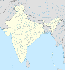
Giddaluru is a town in the Prakasam district of the Indian state of Andhra Pradesh. It is the mandal headquarters of the Giddaluru mandal in Markapur revenue division. It was part of kurnool district till 1969 later it was merged into Prakasam district in 1970. Till 2008 it was under Nandyal parliament segment after delimitation it was moved to Ongole MP segment. Giddalur is also known as "3 zilla la muddu bidda " because during the Britishers rule it was in kadapa district later moved to kurnool then in 1970 merged in prakasam district. Giddalur is the only constituency in coastal districts which has Rayalseema culture,slang and traditions. Giddalur town has good transport connectivity to Nandyal, Markapur, Podili, Ongole, Kurnool, Kadapa.[1]: 16 [2]
Geography
[edit]
Giddaluru is located at 15°21′00″N 78°55′00″E / 15.3500°N 78.9167°E, and is surrounded by the Nallamala Forest in southern India.[3][4]
Demographics
[edit]As of 2011, Giddaluru has a population of 35,150, including 17,728 men and 17,422 women, and children between the ages of 0 and 6 make up 9.8% of the total population. The literacy rate of Giddaluru city is 79.71%, which is higher than the state average of 67.02%.[5]
The majority of inhabitants practice Hinduism (80.78% of the population as of 2011), though Giddaluru also has a sizable Muslim population (17.5% in 2011) and much smaller Christian and Sikh Minorities.[6]
Education
[edit]Primary and secondary education are governed by the School Education Department. There are a total of 61,128 schools within 13 districts. These include 46,137 Government Schools, 2,302 Aided Schools, and 12,689 Private Schools.[7][8] There are two primary languages taught during instruction: English and Telugu. Schools in the locality and nearby areas include AP Model School Racherla, Sri Vidwan Public School, and Kasturba schools.
Sports
[edit]Giddaluru is known for its strong volleyball and kabaddi teams.cricket teams.[citation needed]
References
[edit]- ^ "District Census Handbook – Prakasam" (PDF). Census of India. Directorate of Census Operations, Andhra Pradesh. p. 48. Retrieved 27 April 2019.
- ^ "Part III, District and Sub-District (Mandals)" (PDF). Census of India. The Registrar General & Census Commissioner, India. pp. 151, 177. Retrieved 27 April 2019.
- ^ "Maps, Weather, and Airports for Giddaluru, India". www.fallingrain.com. Retrieved 27 April 2019.
- ^ India, The Hans (21 April 2017). "Wild animals losing lives while searching for water, food". www.thehansindia.com. Retrieved 27 April 2019.
- ^ "Giddalur Census 2011".
- ^ "Giddalur Census 2011".
- ^ "School Education Department" (PDF). School Education Department, Government of Andhra Pradesh. Archived from the original (PDF) on 19 March 2016. Retrieved 7 November 2016.
- ^ "The Department of School Education – Official AP State Government Portal | AP State Portal". www.ap.gov.in. Archived from the original on 7 November 2016. Retrieved 7 November 2016.


