Fowlkes, Tennessee
Appearance
Fowlkes, Tennessee | |
|---|---|
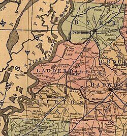
 Map of Lauderdale County, showing Fowlkes in southern Dyer County | |
| Coordinates: 35°58′14″N 89°23′10″W / 35.97056°N 89.38611°W | |
| Country | United States |
| State | Tennessee |
| County | Dyer |
| Founded | 1882 |
| Area | |
• Total | 2.09 sq mi (5.42 km2) |
| • Land | 2.09 sq mi (5.42 km2) |
| • Water | 0.00 sq mi (0.00 km2) |
| Elevation | 341 ft (104 m) |
| Population | |
• Total | 882 |
| • Density | 421.40/sq mi (162.73/km2) |
| Time zone | UTC-6 (Central (CST)) |
| • Summer (DST) | UTC-5 (CDT) |
| ZIP code | 38024[4] |
| Area code | 731 |
| GNIS feature ID | 1284753[2] |
Fowlkes is an unincorporated community in Dyer County, Tennessee, United States.[2]
History
[edit]Originally founded as Fowlkes Station in 1882 by W.P. Fowlkes, the following year the Newport News & Mississippi Valley Railroad was completed in Dyer County. The line for this railroad passed through the community of Fowlkes. By 1887, the community supported a school, a Methodist church, and multiple grist mills and cotton gins.[5][6]
Demographics
[edit]| Census | Pop. | Note | %± |
|---|---|---|---|
| 2020 | 882 | — | |
| U.S. Decennial Census[7] | |||
Education
[edit]The school district is the Dyer County School District.[8] The zoned high school is Dyer County High School in Newbern.
Notes
[edit]- ^ "ArcGIS REST Services Directory". United States Census Bureau. Retrieved October 15, 2022.
- ^ a b c "Fowlkes, Tennessee". Geographic Names Information System. United States Geological Survey, United States Department of the Interior.
- ^ "Census Population API". United States Census Bureau. Retrieved October 15, 2022.
- ^ "Fowlkes TN ZIP Code". zipdatamaps.com. 2023. Retrieved February 17, 2023.
- ^ Goodspeed's History of Tennessee. Nashville, TN: The Goodspeed Publishing Co. 1887. p. 850.
- ^ "Goodspeed History - Dyer County". tn-roots.com. Retrieved July 1, 2024.
- ^ "Census of Population and Housing". Census.gov. Retrieved June 4, 2016.
- ^ "2020 CENSUS - SCHOOL DISTRICT REFERENCE MAP: Dyer County, TN" (PDF). U.S. Census Bureau. Retrieved October 6, 2024. - Text list


