Ernst-Reuter-Platz
Appearance
This article has multiple issues. Please help improve it or discuss these issues on the talk page. (Learn how and when to remove these messages)
|
 Ernst-Reuter-Platz | |
| Former name(s) |
|
| Part of | |
| Namesake | Ernst Reuter |
| Type | Public square |
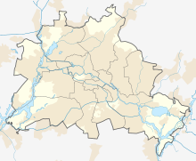
| Location | Berlin, Germany |
| Quarter | Charlottenburg |
| Nearest metro station | |
| Coordinates | 52°30′46″N 13°19′19″E / 52.51264°N 13.32189°E |
| Major junctions | |
| Construction | |
| Inauguration | 18th century |
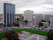
Ernst-Reuter-Platz is a town square in Charlottenburg, Berlin, Germany. It is named after Ernst Reuter, mayor of West Berlin from 1948–1953.
It is located at the end of Straße des 17. Juni, where it continues as Bismarckstraße, and Kaiserdamm, until Theodor-Heuss-Platz.
References
[edit]- ^ "Ernst-Reuter-Platz". Kauperts Straßenführer durch Berlin (in German). Kaupert. Retrieved 16 October 2024.
External links
[edit]![]() Media related to Ernst-Reuter-Platz (Berlin-Charlottenburg) at Wikimedia Commons
Media related to Ernst-Reuter-Platz (Berlin-Charlottenburg) at Wikimedia Commons

