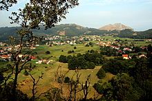
Eastern coast of Cantabria
Appearance
You can help expand this article with text translated from the corresponding article in Spanish. (March 2018) Click [show] for important translation instructions.
|
Costa Oriental
Costa Esmeralda | |
|---|---|
 Colindres | |
 | |
| Country | |
| Autonomous community | Cantabria |
| Province | Cantabria |
| Capital | |
| Municipalities | List |
| Area | |
• Total | 144.26 km2 (55.70 sq mi) |
| Population (2018)[1] | |
• Total | 52,772 |
| • Density | 370/km2 (950/sq mi) |
| Time zone | UTC+1 (CET) |
| • Summer (DST) | UTC+2 (CEST) |
| Largest municipality | Castro Urdiales |
The Eastern Coast of Cantabria is a comarca (shire, but with no administrative role) in the autonomous community of Cantabria, northern Spain, that comprises the municipalities of Colindres, Laredo, Liendo and Castro Urdiales.
Municipalities
[edit]There are 4 municipalities comprising the comarca, listed below with their areas and populations:
| Name | Area (km2) |
Population (2001)[2] |
Population (2011)[3] |
Population (2018)[4] |
|---|---|---|---|---|
| Castro Urdiales | 96.7 | 21,081 | 32,487 | 31,977 |
| Colindres | 5.9 | 6,924 | 8,109 | 8,453 |
| Laredo | 15.7 | 12,559 | 12,088 | 11,148 |
| Liendo | 26.0 | 889 | 1,284 | 1,194 |
References
[edit]


