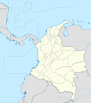
Domingodó, Chocó
Appearance
Domingodó | |
|---|---|
| Coordinates: 7°10′42.6″N 77°2′4.1″W / 7.178500°N 77.034472°W | |
| Country | |
| Department | Chocó |
| Municipality | El Carmen del Darién Municipality |
| Elevation | 36 ft (11 m) |
| Population (2005) | |
• Total | 811[1] |
| Time zone | UTC-5 (Colombia Standard Time) |
Domingodó is a settlement in El Carmen del Darién Municipality, Chocó Department, Colombia.
Climate
[edit]Domingodó has a wet tropical rainforest climate (Af) with heavy rainfall from November to April and very heavy rainfall from May to October.
| Climate data for Domingodó | |||||||||||||
|---|---|---|---|---|---|---|---|---|---|---|---|---|---|
| Month | Jan | Feb | Mar | Apr | May | Jun | Jul | Aug | Sep | Oct | Nov | Dec | Year |
| Mean daily maximum °C (°F) | 30.0 (86.0) |
30.4 (86.7) |
30.8 (87.4) |
31.0 (87.8) |
29.2 (84.6) |
29.4 (84.9) |
29.7 (85.5) |
29.4 (84.9) |
28.9 (84.0) |
28.7 (83.7) |
29.1 (84.4) |
29.1 (84.4) |
29.6 (85.4) |
| Daily mean °C (°F) | 26.1 (79.0) |
26.6 (79.9) |
26.9 (80.4) |
27.1 (80.8) |
26.1 (79.0) |
26.2 (79.2) |
26.4 (79.5) |
26.1 (79.0) |
25.9 (78.6) |
25.7 (78.3) |
25.9 (78.6) |
25.8 (78.4) |
26.2 (79.2) |
| Mean daily minimum °C (°F) | 22.2 (72.0) |
22.8 (73.0) |
23.1 (73.6) |
23.2 (73.8) |
23.1 (73.6) |
23.0 (73.4) |
23.1 (73.6) |
22.9 (73.2) |
22.9 (73.2) |
22.8 (73.0) |
22.7 (72.9) |
22.6 (72.7) |
22.9 (73.2) |
| Average rainfall mm (inches) | 169.4 (6.67) |
122.4 (4.82) |
150.5 (5.93) |
272.1 (10.71) |
380.1 (14.96) |
365.9 (14.41) |
442.3 (17.41) |
399.3 (15.72) |
313.6 (12.35) |
306.2 (12.06) |
299.8 (11.80) |
274.4 (10.80) |
3,496 (137.64) |
| Average rainy days | 8 | 5 | 6 | 12 | 17 | 18 | 19 | 19 | 17 | 16 | 15 | 13 | 165 |
| Source: [2] | |||||||||||||
References
[edit]- ^ "Domingodó (El Carmen del Darién, Chocó, Colombia) - Population Statistics, Charts, Map, Location, Weather and Web Information". www.citypopulation.de.
- ^ "Data". www.ideam.gov.co. Archived from the original on 2016-08-15. Retrieved 2020-06-29.


