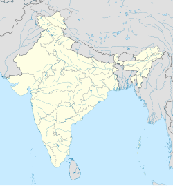
Dolhari Khurd
Appearance
Dolhari Khurd
Dolhari Kh. | |
|---|---|
village | |
| Coordinates: 19°49′19″N 73°03′30″E / 19.8218384°N 73.0582368°E | |
| Country | India |
| State | Maharashtra |
| District | Palghar |
| Taluka | Vikramgad |
| Elevation | 65 m (213 ft) |
| Population (2011) | |
| • Total | 2,260 |
| Time zone | UTC+5:30 (IST) |
| 2011 census code | 551787 |
Dolhari Khurd is a village in the Palghar district of Maharashtra, India. It is located in the Vikramgad taluka.[1]
Demographics
[edit]According to the 2011 census of India, Dolhari Khurd has 449 households. The effective literacy rate (i.e. the literacy rate of population excluding children aged 6 and below) is 60.55%.[2]
| Total | Male | Female | |
|---|---|---|---|
| Population | 2260 | 1136 | 1124 |
| Children aged below 6 years | 379 | 205 | 174 |
| Scheduled caste | 0 | 0 | 0 |
| Scheduled tribe | 2250 | 1132 | 1118 |
| Literates | 1139 | 673 | 466 |
| Workers (all) | 1214 | 649 | 565 |
| Main workers (total) | 925 | 501 | 424 |
| Main workers: Cultivators | 729 | 387 | 342 |
| Main workers: Agricultural labourers | 157 | 89 | 68 |
| Main workers: Household industry workers | 4 | 3 | 1 |
| Main workers: Other | 35 | 22 | 13 |
| Marginal workers (total) | 289 | 148 | 141 |
| Marginal workers: Cultivators | 67 | 51 | 16 |
| Marginal workers: Agricultural labourers | 97 | 48 | 49 |
| Marginal workers: Household industry workers | 22 | 3 | 19 |
| Marginal workers: Others | 103 | 46 | 57 |
| Non-workers | 1046 | 487 | 559 |
References
[edit]- ^ "Maharashtra villages" (PDF). Land Records Information Systems Division, NIC. Archived from the original (PDF) on 4 March 2016. Retrieved 17 August 2015.
- ^ a b "District census data". 2011 Census of India. Directorate of Census Operations. Archived from the original on 2 October 2015. Retrieved 17 August 2015.


