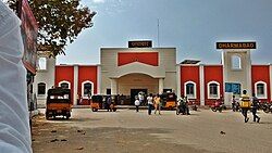
Dharmabad
Dharmabad | |
|---|---|
Town | |
 | |
| Coordinates: 18°54′N 77°51′E / 18.9°N 77.85°E | |
| Country | |
| State | Maharashtra |
| District | Nanded |
| Government | |
| • Type | MUNICIPAL Council |
| Area | |
• Total | 3.583 km2 (1.383 sq mi) |
| Elevation | 359 m (1,178 ft) |
| Population (2015) | |
• Total | 45,196 |
| • Density | 13,000/km2 (33,000/sq mi) |
| Languages | |
| • Official | Marathi |
| Time zone | UTC+5:30 (IST) |
| Area code | 431809 |
| Vehicle registration | MH 26 |
Dharmabad is a town and a municipal council in Nanded district in the state of Maharashtra, India. It is located near the state border with Telangana. Dharmabad has an average elevation of 359 metres (1,178 ft). It is connected by railway. An industrial training institute was established in the town in 1977.[1]
Demographics
[edit]As of 2001[update] India census,[2] Dharmabad had a population of 29,951. Males constitute 51% of the population and females 49%. Dharmabad has an average literacy rate of 58%, lower than the national average of 59.5%: male literacy is 69% and, female literacy is 48%. In Dharmabad, 14% of the population is under 6 years of age.
| Year | Male | Female | Total Population | Change | Religion (%) | |||||||
|---|---|---|---|---|---|---|---|---|---|---|---|---|
| Hindu | Muslim | Christian | Sikhs | Buddhist | Jain | Other religions and persuasions | Religion not stated | |||||
| 2001[3] | 15,212 | 14,739 | 29,951 | - | 64.145 | 24.740 | 0.060 | 0.137 | 10.360 | 0.487 | 0.023 | 0.047 |
| 2011[4] | 16,919 | 16,822 | 33,741 | +12.7% | 61.409 | 27.596 | 0.071 | 0.062 | 10.412 | 0.376 | 0.006 | 0.068 |
Graphs are unavailable due to technical issues. There is more info on Phabricator and on MediaWiki.org. |
Graphs are unavailable due to technical issues. There is more info on Phabricator and on MediaWiki.org. |
Transport
[edit]Dharmabad is connected with the state capital, Mumbai and the capital of neighboring state Telangana, Hyderabad and other major cities like Nizamabad, Nanded and Secunderabad by train. Dharmabad is one of the biggest revenue generating station for South Central Railway. The important trains running from are the Devgiri Express, the Ajanta Express, and the Marathwada Express. The Marathwada Express starts from Dharmabad and is also known as the High Court Express because it connects the Nanded District with Aurangabad High Court.
Dharmabad is also connected with other cities by MSRTC Bus Service. For Lord Vitthal-Rakhumai devotees a bus runs from Dharmabad to Pandharpur. As Dharmabad is located on the Maharashtra–Telangana Border, TSRTC buses also visit the town.
The nearest airport is Nanded Airport. This airport is connected all major cities of India.
Education
[edit]
Dharmabad is also known for its educational institutions.
Some major educational Institutions are:
- Lal Bahadur Shastri (LBS) Jr. & Sr. College, Dharmabad
- Hutatma Pansare Highschool(Semi-English & Marathi Medium), Dharmabad
- Indira Gandhi Public (English medium) School, Dharmabad
- Allama Iqbal Urdu College Dharmabad.
- Zilha Parishad Girls Primary School
- Zilha Parishad High school
- Keshav Primary School
- Saibaba Primary School
- Gurukul Vidyalaya
- Yasvant College Vidyalaya
- Gov. ITI
- Urdu school
- Jijamata Girls High School, Dharmabad
- Rajaram kakani Sahakar Vidya Mandir & Junior College, Dharmabad
Gov Ded college Gitanjali Public School (E/M) Wisdom Techno School (E/M) K.G.B.V. Urdu High School. Urdu Primary School. kasturba gandhi girls school, Dharmabad. And green field public school
Major colleges
[edit]Dharmabad provides bachelor's degree courses institution are as follows:
References
[edit]- ^ Maharashtra (India) (1977). Budget memorandum. Printed at the Govt. Central Press. Retrieved 13 March 2011.
- ^ "Census of India 2001: Data from the 2001 Census, including cities, villages and towns (Provisional)". Census Commission of India. Archived from the original on 16 June 2004. Retrieved 1 November 2008.
- ^ Census India 2001.
- ^ Census India 2011.


