Dahongliutan
Dahongliutan
大红柳滩 Ta-hung-liu-t'an | |
|---|---|
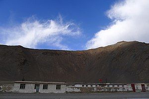
 Dahongliutan army service station | |
| Coordinates: 35°59′N 79°11′E / 35.98°N 79.19°E | |
| Country | China |
| Region | Xinjiang |
| Prefecture | Hotan Prefecture |
| County | Hotan County |
| Elevation | 4,200 m (13,800 ft) |
| Time zone | +8 |
| Dahongliutan | |||||||||
|---|---|---|---|---|---|---|---|---|---|
| Traditional Chinese | 大紅柳灘 | ||||||||
| Simplified Chinese | 大红柳滩 | ||||||||
| Literal meaning | big red willow beach | ||||||||
| |||||||||
| Alternative Chinese name | |||||||||
| Traditional Chinese | 紅柳灘 | ||||||||
| Simplified Chinese | 红柳滩 | ||||||||
| Literal meaning | red willow beach | ||||||||
| |||||||||
Dahongliutan (Chinese: 大红柳滩) or simply Hongliutan (Chinese: 红柳滩[2]) is a village situated in Karakash river valley in the Hotan County, Hotan Prefecture, Xinjiang, China. It is located along the China National Highway 219,[1] and is the town just north of the disputed Aksai Chin region of China and India.
Dahongliutan lies along the China National Highway G219. Following the highway westward, the deserted town of Kangxiwar is about 50 km west and the modern town of Xaidulla is about 115 km west. Following the highway southeastward leads to Aksai Chin. The Tianshuihai army service station in Aksai Chin is about 100 km south along the highway.
History
[edit]Being about a few miles downstream of the bend of Karakash River, the area was noted by the British archaeologist Aurel Stein as the highest point on the Karakash Valley at which there was adequate grazing for pack animals.[3] As such, it was used as a camp by number of European expeditions in the late 1800s and early 1900s. Dahongliutan was roughly where the Mandalik camp was during British explorer George W. Hayward's expedition in the 1860s,[4] and short distance downstream of site of Sora camp during British diplomat Thomas Douglas Forsyth's expedition in the 1870s.[5] It was known as Abdul Ghafur Tam during Aurel Stein's visit in the first decade of 1900s[3] and as Abdul Ghafur Langar during German explorer Emil Trinkler's visit in the late 1920s.[6]
In late 2018, the China Geological Survey announced the discovery of pegmatitic lithium deposits in Dahongliutan during a field visit.[7][8] The commercial exploration rights were auctioned off in late 2019 for CN¥ 2.8 billion.[9][10]
Historical maps
[edit]Historical English-language maps including Dahongliutan, late 20th century:
-
Map including Abdul Ghafur Langar (AMS, 1955)
-
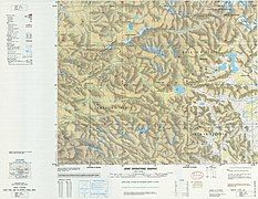
Map including Dahongliutan (Ta-hung-liu-t'an) (DMA, 1982)
Notes
[edit]References
[edit]- ^ a b Mayhew, Bradley; Kohn, Michael (2005). Lonely Planet: Tibet. St. Martin's Press. ISBN 9781740595230. Retrieved 23 December 2019.
Road conditions improve around 60km before you reach the depressing little town of Dahongliutan (4200m), which offers basic food and a guesthouse.
- ^ 泰敢当 (17 January 2019). "当兵走阿里:逝去的戎装,不变的军魂!" (in Chinese). Sohu. Retrieved 9 January 2020.
红柳滩,这里是我个人高原反应最强烈的地方
[permanent dead link] - ^ a b Stein, M. Aurel (1912), Ruins of Desert Cathay, Vol. 2, McMillan – via archive.org
- ^ Hayward, G. W. (1870). "Journey from Leh to Yarkand and Kashgar, and Exploration of the Sources of the Yarkand River". Journal of the Royal Geographical Society of London. 40: 138. doi:10.2307/1798640. ISSN 0266-6235. JSTOR 1798640.
Mandalik (12½ miles) Road down valley for 8 miles, where strike main valley of the Karakash River, continuing down right side of valley to Mandalik. Grass and fuel everywhere obtainable on the march from here downwards.
- ^ Thomas Douglas Forsyth (1875). Report of a Mission to Yarkund in 1873, under command of Sir T[homas] D[ouglas] Forsyth, ... with historical and geographical information regarding the possessions of the Ame̱r of Yarkund. Foreign Departm. Press. p. 428.
Camp Sora (height 14,000 feet). -- At 5 miles river takes sharp bend to north-west into broad valley at foot of Kuen Luen. For 2 miles on either side of the bend is no fuel or grass. Ground at Sora covered with natural salt pans. Good camping ground. Feel and grass abundant.
- ^ Trinkler, Emil (1930). "Explorations in the Eastern Karakoram and in the Western Kunlun". The Geographical Journal. 75 (6): 505. doi:10.2307/1784484. ISSN 0016-7398. JSTOR 1784484.
- ^ 张作衡 (Sep 2017). "2017年矿产资源地质调查新进展" (PDF) (in Chinese). China Geological Survey. p. 35. Retrieved 16 January 2020.
大红柳滩地区发现的伟晶岩型锂矿主要包括阿克塔斯、阿克沙依、509道班西、新发现1号和2号等5个脉群
- ^ 李侃 (2018-10-12). "西昆仑大红柳滩锂矿找矿有新突破" (in Chinese). China Geological Survey. Retrieved 16 January 2020.
- ^ 刘兵 (2019-10-25). "新疆公开招标出让两个金属矿探矿权 中标总价达28亿元" (in Chinese). Xinhua News. Archived from the original on November 1, 2019. Retrieved 16 January 2020.
近日新疆阿克陶县穆呼锰矿、和田县大红柳滩锂铍多金属矿经自治区人民政府批准进行了探矿权公开招标出让,6家国内大中型矿业企业参与投标,新疆有色金属工业(集团)有限责任公司以28亿元的最高报价中标。
- ^ Shi, Xin; Zhao, Xing-mei (2019-12-11). "State-owned enterprise "residence in villages and townships" construction project strong industry precision efforts to fight poverty in South Xinjiang". Kashgar Information Network. Retrieved 16 January 2020.
In September, the Nonferrous Metal Group won the exploration right of the Mohu manganese mine in Akto County and the Dahongliutan lithium beryllium polymetallic mine project in Hetian County with a bid price of 2.8 billion yuan.
[permanent dead link]


![Map of the region including Dahongliutan (labeled as Ta-hung-li-t'an (Dahangliutan [sic])) (DMA, 1995)[a]](/uploads/wikipedia/commons/thumb/e/ee/Txu-pclmaps-oclc-22834566_g-7d.jpg/238px-Txu-pclmaps-oclc-22834566_g-7d.jpg?auto=webp)
![1988 CIA map of Aksai Chin including Dahongliutan[b]](/uploads/wikipedia/commons/thumb/5/56/China_India_western_border_88.jpg/148px-China_India_western_border_88.jpg?auto=webp)