Couthuin Airport
Appearance
Couthuin Airport | |||||||||||
|---|---|---|---|---|---|---|---|---|---|---|---|
| Summary | |||||||||||
| Airport type | Public | ||||||||||
| Serves | Héron | ||||||||||
| Location | Belgium | ||||||||||
| Elevation AMSL | 607 ft / 185 m | ||||||||||
| Coordinates | 50°32′16″N 005°006′26″E / 50.53778°N 5.10722°E | ||||||||||
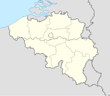
| Map | |||||||||||
 | |||||||||||
| Runways | |||||||||||
| |||||||||||
Source: Landings.com[1] | |||||||||||
Couthuin Airport (ICAO: EBHE) was a public use airport located near Héron, Liège, Belgium.
See also
[edit]References
[edit]- ^ Airport record for Couthuin Airport at Landings.com. Retrieved 2013-08-09

