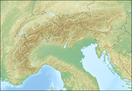
Col de l'Aiguillon
Appearance
| Col de l'Aiguillon | |
|---|---|
 | |
| Elevation | 1,293 m (4,242 ft) |
| Traversed by | Road |
| Location | Switzerland |
| Range | Jura Mountains |
| Coordinates | 46°47′22″N 6°27′34″E / 46.78944°N 6.45944°E |
Col de l'Aiguillon (French pronunciation: [kɔl də lɛɡɥijɔ̃]; el. 1293 m.) is a Swiss pass in the Jura Mountains in the canton of Vaud.
The pass connects L'Auberson and Baulmes. The road is 13.7 km long and has a maximum grade of 18 percent.
The cliff between the Col de l'Aiguillon and the highest point in the neighboring mountains, the Aiguilles de Baulmes, is a popular climbing wall for mountaineers.
See also
[edit]References
[edit]
Wikimedia Commons has media related to Col de l'Aiguillon.

