Cobán Airport
Appearance
Cobán Airport Aerodomo de Cobán | |||||||||||
|---|---|---|---|---|---|---|---|---|---|---|---|
 | |||||||||||
| Summary | |||||||||||
| Airport type | Public | ||||||||||
| Operator | Government | ||||||||||
| Serves | Cobán, Guatemala | ||||||||||
| Elevation AMSL | 4,339 ft / 1,323 m | ||||||||||
| Coordinates | 15°28′10″N 90°24′25″W / 15.46944°N 90.40694°W | ||||||||||
| Map | |||||||||||
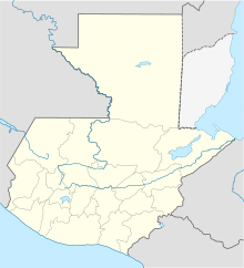
Location in Alta Verapaz Department Location in Guatemala | |||||||||||
 | |||||||||||
| Runways | |||||||||||
| |||||||||||
Cobán Airport (Spanish: Aerodomo de Cobán, IATA: CBV, ICAO: MGCB) is an airport serving Cobán, the capital of the Alta Verapaz Department of Guatemala.
The airport is at the western edge of the city. There is mountainous terrain north through southwest, and distant rising terrain south. An overrun to the south will descend into a shallow ravine.[3]
The Rabinal VOR-DME (Ident: RAB) is located 27.9 nautical miles (51.7 km) south of the airport.[4]
See also
[edit]References
[edit]- ^ "Airport information for MGCB". World Aero Data. Archived from the original on 2019-03-05. Data current as of October 2006.
- ^ Airport information for Cobán Airport at Great Circle Mapper.
- ^ a b Google Maps - Cobán
- ^ "Rabinal VOR". Our Airports. Archived from the original on 24 August 2018. Retrieved 1 September 2018.
External links
[edit]- Current weather for MGCB at NOAA/NWS
- Accident history for CBV at Aviation Safety Network
- OpenStreetMap - Cobán
- FallingRain - Cobán Airport


