Coastal Prairie Conservancy
A major contributor to this article appears to have a close connection with its subject. (April 2010) |
| Formation | 1992 |
|---|---|
| Type | Nonprofit |
| 76-0377029 | |
| Legal status | 501(c)(3) |
| Purpose | Conservation and Restoration |
| Headquarters | Houston, Texas |
Board Chairman | Sam Hix |
President & Chief Executive Officer | Mary Anne Piacentini |
| Sam Hix; Michael Huffmaster; C. Foster Carter; Iris Poteet; Andres Cabada; Robin Fredrickson; Kirk Johnson; Jessica Jubin; Molly McBirney; Juliana Spinola; Forrest Wylie | |
| Website | https://www.coastalprairieconservancy.org/ |
Formerly called | Katy Prairie Conservancy |
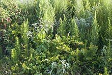
Coastal Prairie Conservancy was established in 1992 to conserve Katy Prairie, part of the Western Gulf coastal grasslands located in Texas, United States. Approximately 24,500 acres is under conservation easements or owned by CPC in western Harris and Waller Counties.[1]
Preserves
[edit]Nelson Farms Preserve
[edit]
Nelson Farms Preserve encompasses more than 1,700 acres, of which 200 acres still operates as a working rice farm. Cypress Creek flows through the preserve and the combination of habitat types attracts waterfowl, waterbirds, migratory songbirds, raptors, beaver, white-tailed deer and other wildlife.
Warren Ranch
[edit]
Warren Ranch is one of the largest remaining working cattle ranches on the prairie.
Williams Prairie Preserve
[edit]
Williams Prairie is a 10 acre prairie remnant where little bluestem, brownseed Paspalum, and indiangrass grow. Egrets and other herons reside in the depressions during the warmer months as long as they contain water.
Other protected areas on the Katy Prairie
[edit]West Side Airport Wetlands Mitigation Area
[edit]In 1986, the City of Houston purchased 1,432 acres for a potential future airport on Morton Road near the western edge of the Katy Prairie.[2] During the expansion of this airport the a area was set aside to compensate migratory birds for the habitat destroyed by the airport.[3]
John Paul Landing Park
[edit]John Paul Landing Park is a 865-acre public park operated by Harris County and located on Katy-Hockley Road and Sharp Road on the Katy Prairie. The project ncludes 400-acre lake as well as an environmental education center.[4]
Paul D. Rushing Park
[edit]Paul D. Rushing Park is a 232-acre public park operated by Harris County, located at 9114 Katy Hockley Road on the Katy Prairie. This park includes a lake and wildlife viewing area.[5]
Katy Park
[edit]Katy Park is a municipal park located inside the City of Katy.[6][7][8]
References
[edit]- ^ "KPC". Katyprairie.org. Retrieved February 13, 2019.
- ^ Berryhill, Michael (September 11, 1997). "The Airport That Wouldn't Die". Houston Press. Retrieved February 13, 2019.
- ^ George Bush Intercontinental Airport, Houston, Runway 8L-2R and Associated Near-term Master Plan Projects: Environmental Impact Statement. Vol. 3. US Department of Transportation. 2000. pp. 83–.
- ^ Brust, Amelia (June 24, 2017). "John Paul's Landing expanding fishing opportunities in Katy". Community Impact Newspaper. Retrieved February 13, 2019.
- ^ "Paul D. Rushing Park". Pct3.com. Retrieved February 13, 2019.
- ^ "Katy Park". Pct3.com. Retrieved February 13, 2019.
- ^ "Mary Jo Peckham Park". Pct3.com. Retrieved February 13, 2019.
- ^ Knipp, Bethany (April 21, 2017). "Katy approves detention pond near Katy Park". Community Impact Newspaper. Retrieved February 13, 2019.
Further reading
[edit]- Bohnen, Julia; Hanchek, Ann (August 6–9, 1992). "Native grass and wildflower seed: an LCMR grant". Proceedings of the Thirteenth North American Prairie Conference. Windsor, Ontario Canada: Windsor Department of Parks and Recreation. pp. 239–241.
- Cameron, G (October 24, 1996). "Impact of exotic species on biodiversity of coastal prairie". The Coastal Prairie and Native Grasses Symposium. Houston Texas: United States Geological Survey.
- Chadwick, D (1995). "What good is a prairie?". Audubon. 97 (6). National Audubon Society: 36–46, 114–117.
- Honing, Robert; Wieland, Gregory (February 22–26, 1997). "The Houston Region Native Grass Seedbank: a natural partnership between right-of-way management and conservation". The Sixth International Symposium on Environmental Concerns in Rights-of-Way Management. New Orleans, Louisiana: Elsevier Science Ltd. Archived from the original on January 16, 2005. Retrieved November 6, 2008.
- McFarlane, Robert (April 29–30, 1994). "Birdlife on the Katy Prairie". Katy Prairie Conference 1994. Katy Prairie Conservancy. p. 8.
- Wermund, E.G. (April 29–30, 1994). "Geology and Physical Features of the Katy Prairie". Katy Prairie Conference 1994. Katy Prairie Conservancy. p. 1.
- Texas Mid-Coast Initiative Team (1990). Texas Mid-Coast Initiative: Gulf Coast Joint Venture, North American Waterfowl Management Plan. Albuquerque, New Mexico: United States Fish and Wildlife Service. p. 27.
- "Plant communities of Texas, series level". Texas Natural Heritage Program. 97 (6). Austin, Texas: Texas Parks and Wildlife Department: 26. 1993.
- Nature conservation organizations based in the United States
- Nature reserves in Texas
- Protected areas of Harris County, Texas
- Protected areas of Fort Bend County, Texas
- Protected areas of Waller County, Texas
- Environmental organizations based in Texas
- Grasslands of Texas
- 1992 establishments in Texas
- 1992 establishments in the United States
- Organizations established in 1992
- Environmental organizations established in 1992
