Chute-aux-Outardes
Appearance
Chute-aux-Outardes | |
|---|---|
| Coordinates: 49°07′N 68°24′W / 49.117°N 68.400°W[1] | |
| Country | Canada |
| Province | Quebec |
| Region | Côte-Nord |
| RCM | Manicouagan |
| Constituted | March 7, 1951 |
| Government | |
| • Mayor | Christian Malouin |
| • Federal riding | Manicouagan |
| • Prov. riding | René-Lévesque |
| Area | |
• Total | 9.76 km2 (3.77 sq mi) |
| • Land | 7.51 km2 (2.90 sq mi) |
| Population (2021)[3] | |
• Total | 1,391 |
| • Density | 185.3/km2 (480/sq mi) |
| • Pop (2016-21) | |
| • Dwellings | 731 |
| Time zone | UTC−5 (EST) |
| • Summer (DST) | UTC−4 (EDT) |
| Postal code(s) | |
| Area code(s) | 418 and 581 |
| Highways | |
| MAMH code | 96035[2] |
| Toponymie info | 13494[1] |
| Website | www |
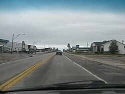
Chute-aux-Outardes is a village municipality in Quebec, Canada, at the mouth of the Outardes River. It is about 20 kilometres (12 mi) south-west of Baie-Comeau along Route 138.
Demographics
[edit]In the 2021 Census of Population conducted by Statistics Canada, Chute-aux-Outardes had a population of 1,391 living in 693 of its 731 total private dwellings, a change of -11% from its 2016 population of 1,563. With a land area of 7.51 km2 (2.90 sq mi), it had a population density of 185.2/km2 (479.7/sq mi) in 2021.[3]
|
|
| ||||||||||||||||||||||||||||||||||||||||||||||||||||||
| Source: Statistics Canada[4] | ||||||||||||||||||||||||||||||||||||||||||||||||||||||||
Mother tongue (2021):[3]
- English as first language: 0.4%
- French as first language: 99.6%
- English and French as first language: 0%
- Other as first language: 0%
Education
[edit]Centre de services scolaire de l'Estuaire operates francophone public schools, including:
- École Richard[5]
The Eastern Shores School Board operates anglophone public schools, including:
- Baie Comeau High School in Baie-Comeau[6]
References
[edit]- ^ a b "Banque de noms de lieux du Québec: Reference number 13494". toponymie.gouv.qc.ca (in French). Commission de toponymie du Québec.
- ^ a b c "Répertoire des municipalités: Geographic code 96035". www.mamh.gouv.qc.ca (in French). Ministère des Affaires municipales et de l'Habitation. Retrieved 2024-06-19.
- ^ a b c d "Data table, Census Profile, 2021 Census of Population - Chute-aux-Outardes, Village (VL) [Census subdivision], Quebec". 9 February 2022.
- ^ 1996, 2001, 2006, 2011, 2016, 2021 census
- ^ "Écoles primaires".
- ^ "Eastern Shores School Board".
External links
[edit]Wikimedia Commons has media related to Chute-aux-Outardes.


