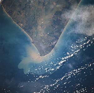
Cape South
Appearance

Cape South (Indonesian: Tanjung Selatan), formerly known as Cape Silat, is the southernmost point on the island of Kalimantan (also known as Borneo), at 4°10′S 114°37′E / 4.167°S 114.617°E.
Geography
[edit]Administratively it is part of South Kalimantan province of Indonesia.[1]
Research on catches in the waters of Tanjung Selatan and other places shows that in the southeast wind season, catches are more likely than in the southwest monsoon wind.[2]
References
[edit]- ^ Pub163, 2005 Sailing Directions (Enroute): Borneo, Jawa, Sulawesi, and Nusa Tenggara. ProStar Publications. 2005. ISBN 978-1-57785-654-2.
- ^ Pauly, Daniel; Martosubroto, Purwito (1996). Baseline Studies of Biodiversity: The Fish Resources of Western Indonesia. WorldFish. ISBN 978-971-8709-48-1.
