Buritis, Rondônia
Appearance
Buritis | |
|---|---|
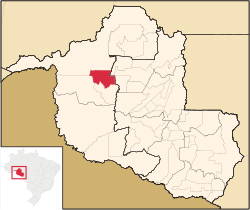
 Location in Rondônia state | |
| Coordinates: 10°12′43″S 63°49′44″W / 10.21194°S 63.82889°W | |
| Country | Brazil |
| Region | North |
| State | Rondônia |
| Area | |
• Total | 3,266 km2 (1,261 sq mi) |
| Population (2020 [1]) | |
• Total | 40,356 |
| • Density | 12/km2 (32/sq mi) |
| Time zone | UTC−4 (AMT) |
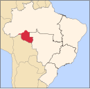
Buritis is a municipality located in the Brazilian state of Rondônia. Its population was 40,356 (2020) and its area is 3,266 km².[2] The city consists largely of unpaved, dirt packed roads.[citation needed] There is one large grocery store of the Goncalves chain.[citation needed] Buritis has one stoplight. Surrounding and outlying farmers rely on Buritis to supply goods and replenish supplies.[citation needed] The city has a democratic government with a mayor and eight sitting Council members for each of the eight sectors. The climate is tropical/equatorial with few variations in temperature and climate from month to month.[3]


