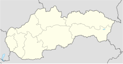
Bretejovce
Bretejovce | |
|---|---|
Municipality | |
| Coordinates: 48°49′40″N 21°17′41″E / 48.82778°N 21.29472°E | |
| Country | Slovakia |
| Region | Prešov |
| District | Prešov |
| First mentioned | 1289 |
| Government | |
| • Mayor | Pavel Mylan |
| Area | |
• Total | 4.37[2] km2 (1.69[2] sq mi) |
| Elevation | 215[3] m (705[3] ft) |
| Population (2021) | |
• Total | 437[1] |
| Postal code | 082 03[3] |
| Area code | +421 51[3] |
| Car plate | PO |
| Climate | Dfb |
| Website | bretejovce |
Bretejovce (Hungarian: Sárosberettő or Berettő) is a village and municipality in Prešov District in the Prešov Region of eastern Slovakia.
History
[edit]The village was first mentioned in historical records in 1289.[5] Before 1918, it was part of Sáros county in Austria-Hungary.
Geography
[edit]The municipality lies at an altitude of 239 metres and covers an area of 4.37 km2 (1.69 sq mi) (2020-06-30/-07-01).[6] It lies on the western bank of the Torysa (river).
Demographics
[edit]In 1787, the village had 37 houses and 323 inhabitants. In 1828, 50 houses and 383 inhabitants. In 1900, there were 351 residents.[5] As of 31 December 2011, the village had a population of 384 people.[7]
Landmarks
[edit]Bretejovce's Roman Catholic church, The Seven Sorrows of Mary or, Our Lady of Sorrows, (Slovak: Kostol Sedembolestnej Panny Márie), was built in the baroque style in 1785,[8] and sits at the top of a hill at the end of the main side street in the village. The church is part of the Budimir parish, and part of the Košice archdiocese. The village's coat of arms incorporates the symbol for the Seven Sorrows of Mary, seven swords piercing a heart.
See also
[edit]References
[edit]- ^ "Počet obyvateľov podľa pohlavia – obce (ročne)". www.statistics.sk (in Slovak). Statistical Office of the Slovak Republic. 31 March 2022. Retrieved 31 March 2022.
- ^ a b "Hustota obyvateľstva – obce [om7014rr_ukaz: Rozloha (Štvorcový meter)]". www.statistics.sk (in Slovak). Statistical Office of the Slovak Republic. 31 March 2022. Retrieved 31 March 2022.
- ^ a b c d "Základná charakteristika". www.statistics.sk (in Slovak). Statistical Office of the Slovak Republic. 17 April 2015. Retrieved 31 March 2022.
- ^ a b "Hustota obyvateľstva – obce". www.statistics.sk (in Slovak). Statistical Office of the Slovak Republic. 31 March 2022. Retrieved 31 March 2022.
- ^ a b Obec Bretejovce: História, archived from the original on 16 October 2013, retrieved 13 October 2013
- ^ "Statistic of Slovak places by Dušan Kreheľ – Export". Archived from the original on 27 June 2021. Retrieved 5 July 2021.
- ^ Mestská a Obecná Štatistika: Bretejovce, archived from the original on 26 February 2011, retrieved 13 October 2013
- ^ Katolícke farnosti Košíc a okolia, retrieved 13 October 2013
Genealogical resources
[edit]The records for genealogical research are available at the state archive "Statny Archiv in Kosice, Slovakia"
- Roman Catholic church records (births/marriages/deaths): 1747–1896 (parish B)
- Greek Catholic church records (births/marriages/deaths): 1819–1898 (parish B)
- Lutheran church records (births/marriages/deaths): 1787–1895 (parish B)
External links
[edit] Media related to Bretejovce at Wikimedia Commons
- Official website

- https://web.archive.org/web/20110226112651/http://app.statistics.sk/mosmis/eng/run.html
- Surnames of living people in Bretejovce

