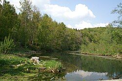
Braunsel
Appearance
You can help expand this article with text translated from the corresponding article in German. (September 2011) Click [show] for important translation instructions.
|
| Braunsel | |
|---|---|
 | |
 | |
| Location | |
| Country | Germany |
| State | Baden-Württemberg |
| Physical characteristics | |
| Mouth | |
• location | Danube |
• coordinates | 48°14′23″N 9°32′18″E / 48.2398°N 9.5383°E |
| Basin features | |
| Progression | Danube→ Black Sea |
The Braunsel is a short river in Baden-Württemberg, Germany. It is 0.9 km (0.6 mi) long and flows into the Danube[1] near Rechtenstein.
See also
[edit]References
[edit]- ^ "Naturschutzgebiet Braunsel". Schwaebische Alb (in German). Schwäbische Alb Tourismusverband e.V. Retrieved 1 December 2024.
