Boucau
You can help expand this article with text translated from the corresponding article in French. (December 2008) Click [show] for important translation instructions.
|
Boucau
| |
|---|---|
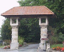
 The west gate of the Guilhou woods | |
| Coordinates: 43°31′28″N 1°29′07″W / 43.5244°N 1.4853°W | |
| Country | France |
| Region | Nouvelle-Aquitaine |
| Department | Pyrénées-Atlantiques |
| Arrondissement | Bayonne |
| Canton | Bayonne-2 |
| Intercommunality | CA Pays Basque |
| Government | |
| • Mayor (2021–2026) | Francis Gonzalez[1] |
Area 1 | 6 km2 (2 sq mi) |
| Population (2022)[2] | 8,934 |
| • Density | 1,500/km2 (3,900/sq mi) |
| Demonym | Boucalais (French)
Bokales (Basque) Bocalés (Gascon) |
| Time zone | UTC+01:00 (CET) |
| • Summer (DST) | UTC+02:00 (CEST) |
| INSEE/Postal code | 64140 /64340 |
| Elevation | 0–51 m (0–167 ft) (avg. 20 m or 66 ft) |
| 1 French Land Register data, which excludes lakes, ponds, glaciers > 1 km2 (0.386 sq mi or 247 acres) and river estuaries. | |
Boucau (French pronunciation: [buko]; Basque: Bokale;[3] Gascon: Lo Bocau) is a commune in the Pyrénées-Atlantiques department and Nouvelle-Aquitaine region of south-western France.[4] It is located in the former province of Labourd.[3]
Geography
[edit]Boucau is a part of Gascony. It borders the Landes department. Boucau is within the Bayonne-Biarritz conurbation, and within the Bayonne urban unit. It covers an area of 5.4 km2 and had a population of 8,200 at the 2016 Census. The density is 1,337 people per square kilometre. The population has grown by 11% since 1999. Surrounded by Bayonne, Anglet and Tarnos, Boucau is 4 km north-west of Bayonne, the largest city of the surrounding region. The city sits 11 metres above sea level, and the Adour river runs through the town. Boucau station has rail connections to Hendaye, Bayonne and Bordeaux.
Hydrography
[edit]The Adour flows through Boucau before flowing into the Bay of Biscay with Tarnos (Landes) on the left bank and Anglet (Pyrenées-Atlantique) on the right. One of the rivers that flows into the Adour, the stream of the Esbouc Mill, runs through Boucau.
Neighbourhoods
[edit]Boucau is divided into nine neighbourhoods. These are:
- Montespan in the north
- Matignon in the north
- Beyré in the north
- Barthassot in the north
- Lahillade in the centre
- Romatet in the centre
- Picquessary in the centre
- Loustau in the south
- Saint-Gobain in the south
Population
[edit]| Year | Pop. | ±% p.a. |
|---|---|---|
| 1968 | 5,831 | — |
| 1975 | 6,091 | +0.63% |
| 1982 | 6,169 | +0.18% |
| 1990 | 6,814 | +1.25% |
| 1999 | 7,007 | +0.31% |
| 2007 | 7,503 | +0.86% |
| 2012 | 7,782 | +0.73% |
| 2017 | 8,350 | +1.42% |
| Source: INSEE[5] | ||
See also
[edit]References
[edit]- ^ "Répertoire national des élus: les maires" (in French). data.gouv.fr, Plateforme ouverte des données publiques françaises. 4 May 2022.
- ^ "Populations de référence 2022" (in French). The National Institute of Statistics and Economic Studies. 19 December 2024.
- ^ a b BOKALE, Auñamendi Eusko Entziklopedia (in Spanish)
- ^ INSEE commune file
- ^ Population en historique depuis 1968, INSEE


