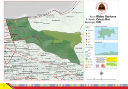
Bidau Santana
Bidau Santana | |
|---|---|
 Map of Bidau Santana | |
| Coordinates: 8°32′56″S 125°35′35″E / 8.54889°S 125.59306°E | |
| Country | |
| Municipality | Dili |
| Administrative posts | Cristo Rei |
| Area | |
• Total | 1.84 km2 (0.71 sq mi) |
| Population (2015)[1] | |
• Total | 6,482 |
| Time zone | UTC +9 |
Bidau Santana is a suco in Cristo Rei Administrative Post, Dili Municipality, East Timor.[2] The administrative area covers an area of 1.84 square kilometres and at the time of the 2015 census it had a population of 6,482 people.[1]
Geography
[edit]Bidau Santana is located to the west of the Cristo Rei Administrative Post, at the east end of the Bay of Dili. Northeast lies Meti Aut, east of the Camea and south of Becora and Culu Hun. To the west, beyond Mota Bidau, is the administrative office of Nain Feto, to which Bidau Santana belonged to until 2004. Becora is bordered by the Benamauc River, which forms the Mota Claran together with the Rio Bemori and flows into the Bay of Dili. Since the municipal reform in 2015, Bidau Santana has an area of 1.84 km2 (0.71 sq mi).[1]
Bidau Santana is divided into four Aldeias. Bidau Mota Claran, Manu Mata and Toko Baru to the west and Sagrada Familia to the east, occupying more than two-thirds of the Suco's area.[3][4] A distinction is also made between the aldeias of Bidau Santana on the coast and Mota Claran in the southwest and Masau in the center.[5] In the suco, there is a primary school in Masau,[4] the Escola Primaria No. 2 Bidau Masau.[6] Two Marian grottos with additional extensions are striking: the Gruta de Bidau Masau and the Gruta de Bidau Santana. In 2019, the B. J. Habibie Bridge was inaugurated[7] and the Jardim B.J. Habibie park opened next to it.[8]
References
[edit]- ^ a b c "Ergebnisse der Volkszählung von 2015". Direcção-Geral de Estatística. Retrieved 23 November 2016.
- ^ "PUBLICAÇÃO OFICIAL DA REPÚBLICA DEMOCRÁTICA DE TIMOR - LESTE" (PDF). Jornal da República, Government of East Timor. 16 September 2009. Archived from the original (PDF) on 1 March 2012. Retrieved 21 July 2012.
- ^ "Jornal da Républica mit dem Diploma Ministerial n.° 199/09" (PDF). www.jornal.gov.tl (in Portuguese). Archived from the original (PDF) on 3 February 2010.
- ^ a b "Atlas der Gemeinde Dili" (PDF). www.statistics.gov.tl. Direcção-Geral de Estatística. Retrieved 21 December 2020.
- ^ "Timor-Leste GIS-Portal". websig.civil.ist.utl.pt. Archived from the original on 30 June 2007. Retrieved 5 March 2022.
- ^ "Liste der Wahllokale" (PDF). 2007 East Timorese parliamentary election.
- ^ Regierung Osttimors: Cerimónia de inauguração da Ponte B.J. Habibie, 29 August 2019, retrieved 11 September 2019.
- ^ Tatoli: Polisia Bandu Transporte Para iha Ponte B. J. Habibie, 2 September 2019, retrieved 11 September 2019.

