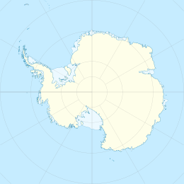
Berkley Island
| Geography | |
|---|---|
| Coordinates | 66°13′S 110°39′E / 66.217°S 110.650°E |
| Archipelago | Swain Islands |
| Length | 1 km (0.6 mi) |
| Administration | |
| Administered under the Antarctic Treaty System | |
| Demographics | |
| Population | Uninhabited |
Berkley Island (66°13′S 110°39′E / 66.217°S 110.650°E) is an island, 1 km long, which marks the north-eastern end of the Swain Islands. It was first mapped from air photos taken by U.S. Navy Operation Highjump, 1946–47, and was included in a survey of the Swain Islands in 1957 by Wilkes Station personnel under Carl R. Eklund. It was named by Eklund for Richard J. Berkley, a geomagnetician with the US-IGY wintering party of 1957 at Wilkes Station.[1]
Important Bird Area
[edit]The island, along with neighbouring Cameron Island, the intervening sea and smaller islets, has been identified as a 97 ha Important Bird Area by BirdLife International because it supports some 14,000 pairs of breeding Adélie penguins (as estimated from January 2011 satellite imagery). It lies about 9 km east of Australia's Casey Station.[2]
See also
[edit]- Composite Antarctic Gazetteer
- List of Antarctic islands south of 60° S
- Scientific Committee on Antarctic Research
- Territorial claims in Antarctica
References
[edit]- ^ "Berkley Island". Geographic Names Information System. United States Geological Survey, United States Department of the Interior. Retrieved 2011-06-08.
- ^ "Berkeley Island / Cameron Island". BirdLife Data Zone. BirdLife International. 2015. Retrieved 25 October 2020.
External links
[edit] This article incorporates public domain material from "Berkley Island". Geographic Names Information System. United States Geological Survey.


