Baratala
Baratala | |
|---|---|
Village | |
| Coordinates: 21°54′52″N 87°55′35″E / 21.9145°N 87.9265°E | |
| Country | |
| State | West Bengal |
| District | Purba Medinipur |
| Population (2011) | |
• Total | 3,680 |
| Languages | |
| • Official | Bengali, English |
| Time zone | UTC+5:30 (IST) |
| Lok Sabha constituency | Kanthi |
| Vidhan Sabha constituency | Khejuri |
| Website | purbamedinipur |
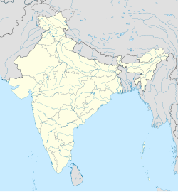
Baratala is a village and a gram panchayat, in Khejuri II CD Block in Contai subdivision of Purba Medinipur district in the state of West Bengal, India.
Geography
[edit]
5miles
Fishing Harbour
Shankarpur
M: municipal city/ town, CT: census town, R: rural/ urban centre, H:historical/ religious centre S: port, sea-beach
Owing to space constraints in the small map, the actual locations in a larger map may vary slightly
Location
[edit]Baratala is located at 21°54′52″N 87°55′35″E / 21.9145°N 87.9265°E.
Urbanisation
[edit]93.55% of the population of Contai subdivision live in the rural areas. Only 6.45% of the population live in the urban areas and it is considerably behind Haldia subdivision in urbanization, where 20.81% of the population live in urban areas.[1]
Note: The map alongside presents some of the notable locations in the subdivision. All places marked in the map are linked in the larger full screen map.
Demographics
[edit]As per 2011 Census of India Baratala had a total population of 3,680 of which 1,892 (51%) were males and 1,790 (49%) were females. Population below 6 years was 484. The total number of literates in Baratala was 2,648 (82.80% of the population over 6 years).[2]
Transport
[edit]Baratala is on the Lalat-Janka Road.[3]
Education
[edit]Khejuri College at Baratala was established in 1999. In addition to courses in arts, it offers a course in Aquaculture Management and Technology.[4][5]
References
[edit]- ^ "District Statistical Handbook 2014 Purba Medinipur". Table 2.2. Department of Planning and Statistics, Government of West Bengal. Archived from the original on 21 January 2019. Retrieved 22 April 2019.
- ^ "2011 Census – Primary Census Abstract Data Tables". West Bengal – District-wise. Registrar General and Census Commissioner, India. Retrieved 26 April 2017.
- ^ Google maps
- ^ "Khejuri College". Khejuri College. Retrieved 26 April 2017.
- ^ "Khejuri College". College Admission. Retrieved 26 April 2017.


