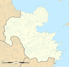
Azamui Station
 Azamui Station in 2008 | |||||||||||
| General information | |||||||||||
| Location | Kamiura Oaza Azamuiura, Saiki-shi, Ōita-ken879-2601 Japan | ||||||||||
| Coordinates | 33°02′37″N 131°55′09″E / 33.04361°N 131.91917°E | ||||||||||
| Operated by | |||||||||||
| Line(s) | ■ Nippō Main Line | ||||||||||
| Distance | 188.2 km from Kokura | ||||||||||
| Platforms | 1 island platform | ||||||||||
| Tracks | 2 + 1 siding | ||||||||||
| Construction | |||||||||||
| Structure type | At grade | ||||||||||
| Other information | |||||||||||
| Status | Unstaffed | ||||||||||
| Website | Official website | ||||||||||
| History | |||||||||||
| Opened | 25 October 1916 | ||||||||||
| Passengers | |||||||||||
| FY2015 | 72 daily | ||||||||||
| Services | |||||||||||
| |||||||||||
| |||||||||||
Azamui Station (浅海井駅, Azamui-eki) is a passenger railway station located in the city of Saiki, Ōita, Japan. It is operated by JR Kyushu.[1][2]
Lines
[edit]The station is served by the Nippō Main Line and is located 188.2 km from the starting point of the line at Kokura.[3]
Layout
[edit]The station, which is unstaffed, consists of an island platform serving two tracks, with a siding. The station building is a simple wooden structure in a basic Japanese style with a tiled roof. It serves only to house a waiting area and an automatic ticket vending machine. Access to the island platform is by means of a footbridge.[2][3][4]
Platforms
[edit]| 1 | ■ ■ Nippō Main Line | for Saiki |
| 2 | ■ ■ Nippō Main Line | for Ōita |
History
[edit]The private Kyushu Railway had, by 1909, through acquisition and its own expansion, established a track from Kokura to Yanagigaura. The Kyushu Railway was nationalised on 1 July 1907. Japanese Government Railways (JGR), designated the track as the Hōshū Main Line on 12 October 1909 and expanded it southwards in phases, with Saiki opening as the new southern terminus on 25 October 1916. On the same day, Azamui was opened as an intermediate station on the new track. On 15 December 1923, the Hōshū Main Line was renamed the Nippō Main Line. With the privatization of Japanese National Railways (JNR), the successor of JGR, on 1 April 1987, the station came under the control of JR Kyushu.[5][6]
Passenger statistics
[edit]In fiscal 2015, there were a total of 26,402 boarding passengers, giving a daily average of 72 passengers.[7]
Surrounding area
[edit]- Saiki City Hall Kamiura Promotion Bureau (formerly Kamiura Town Hall)
- Saiki City Shinonome Elementary School
- Saiki City Shinonome Junior High School
See also
[edit]References
[edit]- ^ "JR Kyushu Route Map" (PDF). JR Kyushu. Retrieved 23 February 2018.
- ^ a b "浅海井" [Azamui]. hacchi-no-he.net. Retrieved 5 May 2018.
- ^ a b Kawashima, Ryōzō (2013). 図説: 日本の鉄道 四国・九州ライン 全線・全駅・全配線・第6巻 熊本 大分 エリア [Japan Railways Illustrated. Shikoku and Kyushu. All lines, all stations, all track layouts. Volume 6 Kumamoto Ōita Area] (in Japanese). Kodansha. pp. 46, 83. ISBN 9784062951654.
- ^ "駅の中に人が住んでいる浅海井駅" [Azamui Station - A station with people residing in it]. Retrieved 5 May 2018. Blog entry with good photographic coverage of station facilities.
- ^ Ishino, Tetsu; et al., eds. (1998). 停車場変遷大事典 国鉄・JR編 [Station Transition Directory – JNR/JR] (in Japanese). Vol. I. Tokyo: JTB Corporation. pp. 228–9. ISBN 4-533-02980-9.
- ^ Ishino, Tetsu; et al., eds. (1998). 停車場変遷大事典 国鉄・JR編 [Station Transition Directory – JNR/JR] (in Japanese). Vol. II. Tokyo: JTB Corporation. p. 755. ISBN 4-533-02980-9.
- ^ "平成28年版 大分県統計年鑑 11 運輸および通信" [Oita Prefecture Statistics Yearbook 2016 Edition Section 11 Transportation and Communications]. Oita Prefectural Government website. Retrieved 8 April 2018. See table 128 Transport situation by individual railway stations (JR Kyushu JR Freight).
External links
[edit]![]() Media related to Azamui Station at Wikimedia Commons
Media related to Azamui Station at Wikimedia Commons
- Azamui (JR Kyushu)(in Japanese)


