Alejandro Gallinal
Appearance
Alejandro Gallinal
Cerro Colorado | |
|---|---|
Village | |
 El Carrillón at Alejandro Gallinal | |
| Coordinates: 33°52′0″S 55°33′0″W / 33.86667°S 55.55000°W | |
| Country | |
| Department | Florida Department |
| Population (2011) | |
• Total | 1,357 |
| Time zone | UTC -3 |
| Postal code | 94101 |
| Dial plan | +598 4318 (+4 digits) |
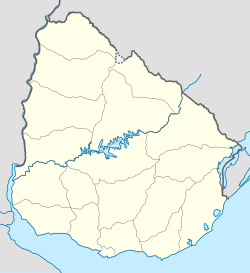
Alejandro Gallinal or Cerro Colorado (old name, still in use) is a village in the Florida Department of southern-central Uruguay.
Geography
[edit]It is located on route 7 of the canal path Route 7, about 142 kilometres (88 mi) northeast of Montevideo.
History
[edit]On 18 December 1952, the locality "Cerro Colorado" was given its new name by decree Ley N° 11.893.[1] Its status was elevated to "Pueblo" (village) by decree Ley N° 15.708 on 28 January 1985.[2]
Population
[edit]In 2011 Alejandro Gallinal had a population of 1,357.[3]
| Year | Population |
|---|---|
| 1963 | 593 |
| 1975 | 906 |
| 1985 | 1,092 |
| 1996 | 1,170 |
| 2004 | 1,336 |
| 2011 | 1,357 |
Source: Instituto Nacional de Estadística de Uruguay[4]
References
[edit]- ^ "LEY N° 11.893". República Oriental del Uruguay, Poder Legislativo. 1952. Archived from the original on 2016-03-04. Retrieved 26 August 2012.
- ^ "Ley Nº 15.708". República Oriental del Uruguay, Poder Legislativo. 1985. Retrieved 4 September 2012.[permanent dead link]
- ^ "Censos 2011 Cuadros Florida". INE. 2012. Archived from the original on 10 October 2012. Retrieved 25 August 2012.
- ^ "Statistics of urban localities (1963–2004)". INE. 2012. Archived from the original (PDF) on 23 March 2015. Retrieved 4 September 2012.
External links
[edit]Wikivoyage has a travel guide for Cerro Colorado.


