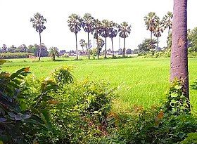
Akhini, Dildarnagar
Appearance
This article needs additional citations for verification. (January 2021) |
Akhini
Tajpur Akhini | |
|---|---|
village | |
 Farms of Akhini village | |
 | |
| Coordinates: 25°23′N 83°42′E / 25.38°N 83.70°E | |
| Country | |
| State | Bihar |
| District | Kaimur |
| Established | 1600 |
| Area | |
• Total | 418 ha (1,033 acres) |
| Population (2011) | |
• Total | 3,950 |
| • Density | 940/km2 (2,400/sq mi) |
| Languages | |
| • Official | Hindi |
| Time zone | UTC+5:30 (IST) |
| Area code | 6187 |
| ISO 3166 code | IN-BR |
Akhini, on the banks of the Karmanasa River, is a village of Kamsaar in the Indian state of Bihar. It is a bordering village of Kaimur district of Bihar. As of 2011 census the main population of the village lived in an area 72.5 acres and 741 house holds.[1]
.[2]
Historical population
[edit]| Year | Pop. | ±% |
|---|---|---|
| 1861 | 1,890 | — |
| 1871 | 2,079 | +10.0% |
| 1881 | 2,286 | +10.0% |
| 1891 | 2,515 | +10.0% |
| 1901 | 2,780 | +10.5% |
| 1911 | 3,045 | +9.5% |
| 1921 | 3,348 | +10.0% |
| 1931 | 3,684 | +10.0% |
| 1941 | 4,052 | +10.0% |
| 1951 | 4,050 | −0.0% |
| 1961 | 4,080 | +0.7% |
| 1971 | 4,488 | +10.0% |
| 1981 | 3,816 | −15.0% |
| 1991 | 3,805 | −0.3% |
| 2001 | 3,900 | +2.5% |
| 2011 | 3,950 | +1.3% |
| Source:Census of India[3][4][5] | ||
References
[edit]- ^ "Bhulekh".
- ^ Ansari, Saiyad Hasan (27 September 1986). ""Evolution and Spatial Organization of Clan Settlements: A Case Study of Middle Ganga Valley"".
- ^ "Census of India". mospi.gov.in. Archived from the original on 13 August 2008. Retrieved 23 June 2008.
- ^ "2011 census of India".
- ^ "Historical Census of India". Archived from the original on 17 February 2013. Retrieved 5 November 2015.
