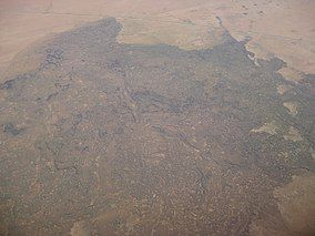
Aden Lava Flow Wilderness
Appearance
| Aden Lava Flow Wilderness | |
|---|---|
| Aden Lava Flow Wilderness Study Area | |
 Oblique air photo of northern part of Aden-Afton Lava Flow, taken August 2011, facing north | |
| Location | Doña Ana County, New Mexico |
| Nearest city | Las Cruces, New Mexico |
| Coordinates | 32°04′N 107°01′W / 32.067°N 107.017°W |
| Area | 25,287 acres (102.33 km2) |
| Designated | 2019 |
| Governing body | Bureau of Land Management |
Aden Lava Flow Wilderness is one of many Wildernesses operated by the Bureau of Land Management (BLM) in New Mexico. It is 25,287 acres (10,233 ha) in size.[1] The John D. Dingell, Jr. Conservation, Management, and Recreation Act, signed March 12, 2019, designates the Wilderness as a component of the National Wilderness Preservation System, protecting approximately 27,673 acres.[2]
Prior to its 2019 designation, it was known as the Aden Lava Flow Wilderness Study Area.
It lies within the Potrillo volcanic field southwest of Las Cruces, and is south of County Road B002. Aden Crater lies at the western side of the lava flow.

References
[edit]- ^ "Aden Lava Flow WSA: Bureau of Land Management". Archived from the original on July 1, 2016. Retrieved May 29, 2016.
- ^ "John D. Dingell, Jr. Conservation, Management, and Recreation Act (S.47)" (PDF). Congress.gov. Retrieved March 16, 2019.


