Ticlla (Cacamayo)
Appearance
(Redirected from Tiklla (Qaqamayu))
| Ticlla | |
|---|---|
| Highest point | |
| Elevation | 4,800 m (15,700 ft)[1] |
| Coordinates | 15°20′38″S 72°07′45″W / 15.34389°S 72.12917°W[2] |
| Naming | |
| Language of name | Quechua |
| Geography | |
| Location | Peru, Arequipa Region |
| Parent range | Andes, Chila |
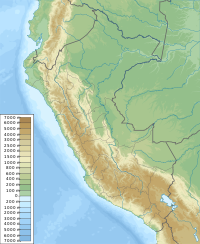
Ticlla (possibly from Quechua for eyelash; two-colored,[3][4] or for 'with alternating colors')[5] is a mountain in the Chila mountain range in the Andes of Peru, about 4,800 m (15,700 ft) high. It is located in the Arequipa Region, Castilla Province, Chachas District. Tiklla lies at the Cacamayo (possibly from Quechua for "rock river"), east of Huayllayoc and southeast of Huamanripayoq.[1]
References
[edit]- ^ a b escale.minedu.gob.pe - UGEL map of the Caylloma Province 1 (Arequipa Region)
- ^ "Cerro Ticlla". IGN, Peru. Retrieved August 5, 2015.
- ^ Teofilo Laime Ajacopa (2007). Diccionario Bilingüe: Iskay simipi yuyayk’anch: Quechua – Castellano / Castellano – Quechua (PDF). La Paz, Bolivia: futatraw.ourproject.org.
- ^ "Diccionario: Quechua - Español - Quechua, Simi Taqe: Qheswa - Español - Qheswa" (PDF). Diccionario Quechua - Español - Quechua. Gobierno Regional del Cusco, Perú: Academía Mayor de la Lengua Quechua. 2005.
- ^ "Diccionario Bilingüe Castellano - Quechua -Quechua - Castellano, 2002". Félix Layme Pairumani. Archived from the original on September 23, 2015. Retrieved August 4, 2015.

