Tell Abyad Subdistrict
Appearance
Tell Abyad Subdistrict
ناحية تل أبيض | |
|---|---|
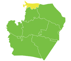
 Location of Tell Abyad Subdistrict within Raqqa Governorate | |
| Coordinates (Tell Abyad): 36°41′53″N 38°57′25″E / 36.698°N 38.957°E | |
| Country | Syria |
| Governorate | Raqqa |
| District | Tell Abyad District |
| Seat | Tell Abyad |
| Control | |
| Population (2004) | 44,671 |
| Geocode | SY110200 |
Tell Abyad Subdistrict or Tell Abyad Nahiyah (Arabic: ناحية تل أبيض) is a Syrian nahiyah (subdistrict) located in Tell Abyad District in Raqqa. According to the Syria Central Bureau of Statistics (CBS), Tell Abyad Subdistrict had a population of 44,671 in the 2004 census.[2] The subdistrict's administrative center (seat) is the town of Tell Abyad and is controlled by the Syrian Interim Government.
References
[edit]36°41′51″N 38°57′24″E / 36.69750°N 38.95667°E

