South Atlantic tropical cyclone

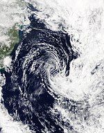
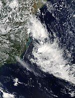
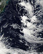
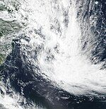
South Atlantic tropical cyclones are unusual weather events that occur in the Southern Hemisphere. Strong wind shear, which disrupts the formation of cyclones, as well as a lack of weather disturbances favorable for development in the South Atlantic Ocean, make any strong tropical system extremely rare, and Hurricane Catarina in 2004 is the only recorded South Atlantic hurricane in history. Storms can develop year-round in the South Atlantic, with activity peaking during the months from November through May. Since 2011, the Brazilian Navy Hydrographic Center has assigned names to tropical and subtropical systems in the western side of the basin, near the eastern coast of Brazil, when they have sustained wind speeds of at least 65 km/h (40 mph), the generally accepted minimum sustained wind speed for a disturbance to be designated as a tropical storm in the North Atlantic basin. Below is a list of notable South Atlantic tropical and subtropical cyclones.
Theories concerning infrequency of occurrence
[edit]It was initially thought that tropical cyclones did not develop within the South Atlantic.[1] Very strong vertical wind shear in the troposphere is considered a deterrent.[2] The Intertropical Convergence Zone drops one to two degrees south of the equator,[3] not far enough from the equator for the Coriolis force to significantly aid development. Water temperatures in the tropics of the southern Atlantic are cooler than those in the tropical north Atlantic.[4]
Although they are rare, during April 1991 the United States' National Hurricane Center (NHC) reported that a tropical cyclone had developed over the Eastern South Atlantic.[1][5] In subsequent years, a few systems were suspected to have the characteristics needed to be classified as a tropical cyclone, including in March 1994 and January 2004.[6][7] During March 2004, an extratropical cyclone formally transitioned into a tropical cyclone and made landfall on Brazil, after becoming a Category 2 hurricane on the Saffir–Simpson hurricane wind scale. While the system was threatening the Brazilian state of Santa Catarina, a newspaper used the headline "Furacão Catarina", which was originally presumed to mean "furacão (hurricane) threatening (Santa) Catarina (the state)".[1] After international presses started monitoring the system, "Hurricane Catarina" has formally been adopted.
At the Sixth WMO International Workshop on Tropical Cyclones (IWTC-VI) in 2006, it was questioned if any subtropical or tropical cyclones had developed within the South Atlantic before Catarina.[7] It was noted that suspect systems had developed in January 1970, March 1994, January 2004, March 2004, May 2004, February 2006, and March 2006.[7] It was also suggested that an effort should be made to locate any possible systems using satellite imagery and synoptic data; however, it was noted that this effort may be hindered by the lack of any geostationary imagery over the basin before 1966.[7] A study was subsequently performed and published during 2012, which concluded that there had been 63 subtropical cyclones in the Southern Atlantic between 1957 and 2007.[8] During January 2009, a subtropical storm developed in the basin, and in March 2010, a tropical storm developed, which was named Anita by the Brazilian public and private weather services.[9][10] In 2011, the Brazilian Navy Hydrographic Center started to assign names to tropical and subtropical cyclones that develop within its area of responsibility, to the west of 20°W, when they have sustained wind speeds of at least 65 km/h (40 mph).[11]
Notable storms and impacts
[edit]Pre-2010s
[edit]1991 Angola tropical storm
[edit]| Tropical storm (SSHWS) | |
| Duration | 10 April 1991 – 14 April 1991 |
|---|---|
| Peak intensity | 65 km/h (40 mph) (1-min); |
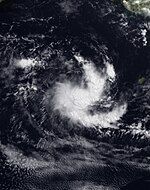
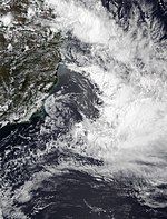
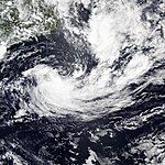
A low-pressure area formed over the Congo Basin on 9 April. The next day it moved offshore northern Angola with a curved cloud pattern. It moved westward over an area of warm waters while the circulation became better defined. According to the United States National Hurricane Center, the system was probably either a tropical depression or a tropical storm at its peak intensity. On 14 April, the system rapidly dissipated, as it was absorbed into a large squall line.[5][12] This is the only recorded tropical cyclone in the eastern South Atlantic.
Hurricane Catarina
[edit]This section needs additional citations for verification. (January 2023) |
| Category 2 hurricane (SSHWS) | |
| Duration | 24 March 2004 – 28 March 2004 |
|---|---|
| Peak intensity | 155 km/h (100 mph) (1-min); 972 hPa (mbar) |
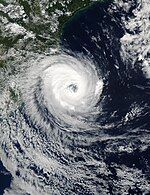
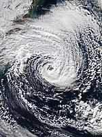
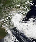
Hurricane Catarina was an extraordinarily rare hurricane-strength tropical cyclone, forming in the southern Atlantic Ocean in March 2004.[13] Just after becoming a hurricane, it hit the southern coast of Brazil in the state of Santa Catarina on the evening of 28 March, with winds up to 195 kilometres per hour (121 mph) making it a Category 2-equivalent cyclone on the Saffir–Simpson hurricane scale.[14] Catarina killed 3 to 11 people and caused millions of dollars in damage in Brazil.[15]
At the time, Brazilians were taken completely by surprise, and were initially skeptical that an actual tropical cyclone could have formed in the South Atlantic. Eventually, however, they were convinced, and adopted the previously unofficial name "Catarina" for the storm, after Santa Catarina state. This event is considered by some meteorologists to be a nearly once-in-a-lifetime occurrence.
2010s
[edit]Tropical Storm Anita
[edit]| Tropical storm (SSHWS) | |
| Duration | 8 March 2010 – 12 March 2010 |
|---|---|
| Peak intensity | 85 km/h (50 mph) (1-min); 995 hPa (mbar) |
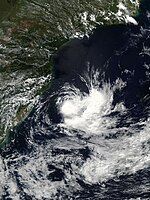
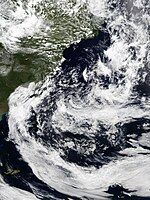
On 8 March 2010, a previously extratropical cyclone developed tropical characteristics and was classified as a subtropical cyclone off the coast of southern Brazil. The following day, the United States Naval Research Laboratory began monitoring the system as a system of interest under the designation of 90Q. The National Hurricane Center also began monitoring the system as Low SL90. During the afternoon of 9 March, the system had attained an intensity of 55 km/h (34 mph) and a barometric pressure of 1000 hPa (mbar). It was declared a tropical storm on 10 March and became extratropical late on 12 March.[16] Anita's accumulated cyclone energy was estimated at 2.0525 by the Florida State University. There was no damage associated to the storm, except high sea in the coasts of Rio Grande do Sul and Santa Catarina. Post mortem, the cyclone was given the name "Anita" by private and public weather centers in Southern Brazil.[17]
Subtropical Storm Arani
[edit]| Subtropical storm (SSHWS) | |
| Duration | 14 March 2011 – 16 March 2011 |
|---|---|
| Peak intensity | 85 km/h (50 mph) (1-min); 998 hPa (mbar) |
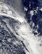
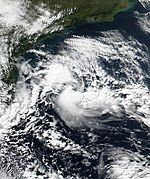
Early on 14 March 2011, the Navy Hydrographic Center-Brazilian Navy (SMM), in coordination with the National Institute of Meteorology, were monitoring an organizing area of convection near the southeast coast of Brazil.[18] Later that day a low-pressure area developed just east of Vitória, Espírito Santo,[19] and by 12:00 UTC, the system organized into a subtropical depression, located about 140 km (87 mi) east of Campos dos Goytacazes.[20] Guided by a trough and a weak ridge to its north, the system moved slowly southeastward over an area of warm waters,[21][22] intensifying into Subtropical Cyclone Arani on 15 March,[23] as named by the Brazilian Navy Hydrographic Center,[24] and achieving its lowest pressure.[25] The storm was classified as subtropical, as the convection was east of the center. On 16 March, Arani began experiencing 25 kn (13 m/s; 46 km/h; 29 mph) of wind shear because another frontal system bumped it from behind.[26] As it moved east-southeastwards, it achieved its highest winds as it transitioned back to an extratropical cyclone, process that was concluded on early 17 March.[25]
Before it developed into a subtropical cyclone, Arani produced torrential rains over portions of southeastern Brazil, resulting in flash flooding and landslides. Significant damage was reported in portions of Espírito Santo, though specifics are unknown.[27] Increased swells along the coast prompted ocean travel warnings.[28]
Subtropical Storm Bapo
[edit]| Subtropical storm (SSHWS) | |
| Duration | 5 February 2015 – 7 February 2015 |
|---|---|
| Peak intensity | 65 km/h (40 mph) (1-min); 992 hPa (mbar) |
On 5 February 2015, a subtropical depression developed about 105 nautical miles (195 km; 120 mi) to the southeast of São Paulo, Brazil.[29] During the next day, low-level baroclinity decreased around the system, as it moved southeastwards away from the Brazilian coast and into anomalously warm waters, where it intensified further.[30][31] The system was named Bapo by the Brazilian Navy Hydrography Center during 6 February as it had intensified into a subtropical storm.[32][33] Over the next couple of days the system continued to move south-eastwards, achieving its peak intensity just before it transitioned into an extratropical cyclone during 8 February.[34][31]
Subtropical Storm Cari
[edit]| Subtropical storm (SSHWS) | |
| Duration | 10 March 2015 – 13 March 2015 |
|---|---|
| Peak intensity | 65 km/h (40 mph) (1-min); 998 hPa (mbar) |
On 10 March 2015, the Hydrographic Center of the Brazilian Navy began issuing warnings on Subtropical Depression 3 during early afternoon,[35] while the Center for Weather Forecast and Climatic Studies (CPTEC in Portuguese) already assigned the name Cari for the storm.[36] At 00:00 UTC on 11 March, the Hydrographic Center of the Brazilian Navy upgraded Cari to a subtropical storm, also assigning this name to it.[37][38] On 12 March, the Brazilian Hydrographic Center downgraded Cari to a subtropical depression as it achieved its lowest pressure,[39][38] while the CPTEC stated that the storm had become a "Hybrid cyclone"[40] as it moved away from the continental coastline.[38] During early afternoon of 13 March, the Brazilian Navy declared that Cari became a remnant low.[41]
Cari brought heavy rainfall, flooding and landslides to eastern cities of Santa Catarina and Rio Grande do Sul states as it interacted with a South Atlantic Convergence Zone.[42][38] Rain totals from 100 to 180 mm (3.9 to 7.1 in) were observed associated with the storms and wind topped 75 km/h (47 mph) in Cabo de Santa Marta.[42] A Navy buoy registered a 6-metre (20 ft) wave off the coast of Santa Catarina.[42]
Subtropical Storm Deni
[edit]| Subtropical storm (SSHWS) | |
| Duration | 15 November 2016 – 16 November 2016 |
|---|---|
| Peak intensity | 75 km/h (45 mph) (1-min); 998 hPa (mbar) |
On 15 November 2016, instability areas associated with a trough axis over Rio de Janeiro's coastline led to the formation of a subtropical depression southwest of it.[43][44] It intensified into a subtropical storm and received the name Deni on 16 November.[45] Moving south-southeastwards, Deni soon became extratropical shortly before 00:00 UTC on 17 November,[46] where it was absorbed by a mid-latitude frontal system.[43]
Subtropical Storm Eçaí
[edit]| Subtropical storm (SSHWS) | |
| Duration | 4 December 2016 – 6 December 2016 |
|---|---|
| Peak intensity | 100 km/h (65 mph) (1-min); 992 hPa (mbar) |
An extratropical cyclone entered the South Atlantic Ocean from Santa Catarina early on 4 December 2016.[47] Later, it intensified quickly and then transitioned into a subtropical storm shortly before 22:00 BRST (00:00 UTC on 5 December), with the name Eçaí assigned by the Hydrographic Center of the Brazilian Navy.[48] Eçaí started to decay on 5 December as it moved Into cooler waters, and weakened into a subtropical depression at around 00:00 UTC on 6 December.[49][50] As it decayed and lost its subtropical characteristics, its center divided in two, with the new center moving away southeastwards and the old one degrading into a remnant frontal low.[49]
Subtropical Storm Guará
[edit]| Subtropical storm (SSHWS) | |
| Duration | 9 December 2017 – 10 December 2017 |
|---|---|
| Peak intensity | 75 km/h (45 mph) (1-min); 996 hPa (mbar) |
According to the Brazilian Navy Hydrographic Center, on 8 December 2017 a South Atlantic Convergence Zone aligned with a through axis led to the formation of several instability areas.[51] On 9 December a subtropical storm formed from this setup, on border between Espírito Santo and Bahia, moving southeastwards away from land.[51][52][53][54] On late 10 December, a Cold front pushed Guará southwards towards cooler waters, where it started transitioning into an extratropical cyclone.[51] On early 11 December Guará attained its peak intensity,[55] shortly thereafter degenerating into a low-pressure area associated with a through axis.[51][56]
Tropical Storm Iba
[edit]| Tropical storm (SSHWS) | |
| Duration | 23 March 2019 – 27 March 2019 |
|---|---|
| Peak intensity | 85 km/h (50 mph) (1-min); 1006 hPa (mbar) |
According to the Brazilian Navy Hydrographic Center, on 22 March 2019, a low-pressure area formed off the coast of Bahia after the passage of a frontal system.[57] On the next day, the cyclone developed a deep warm-core, thus being designated as a tropical depression.[57][58][59] On 24 March, the system intensified into a tropical storm, receiving the name Iba from the Brazilian Navy Hydrographic Center.[57] After moving southwestward for a couple of days, on 26 March, Iba reached its peak intensity.[57] Afterward, a cold front would approach the storm, which helped intensify the wind shear impacting Iba, leading to its weakening and extratropical transition.[57] On early 28 March, Iba would degenerate into a remnant low, becoming fully extratropical a day later.[57][60]
Iba was the first tropical storm to develop in the basin since Anita in 2010, as well as the first fully tropical system to be named from the Brazilian naming list.[61]
Subtropical Storm Jaguar
[edit]| Subtropical storm (SSHWS) | |
| Duration | 19 May 2019 – 21 May 2019 |
|---|---|
| Peak intensity | 65 km/h (40 mph) (1-min); 1010 hPa (mbar) |
According to the Brazilian Navy Hydrographic Center, on 19 May 2019 several instability areas formed from a through axis off the coast of Espírito Santo, which later coalesced into a subtropical depression.[62] On 20 May, the system strengthened into a subtropical storm, receiving the name Jaguar from the Brazilian Navy Hydrographic Center.[63] However, the system did not intensify any further, as it soon encountered unfavorable conditions while moving southeastwards, weakening into a subtropical depression on early 21 May.[62] Later that day, Jaguar degenerated into several sparse instability areas associated with a low-pressure area, which was absorbed by a frontal system on 22 May.[62]
2020s
[edit]Subtropical Storm Kurumí
[edit]| Subtropical storm (SSHWS) | |
| Duration | 23 January 2020 – 24 January 2020 |
|---|---|
| Peak intensity | 65 km/h (40 mph) (1-min); 998 hPa (mbar) |
On 21 January 2020, the Brazilian Navy Hydrographic Center began monitoring an area of persisting thunderstorms near São Paulo for potential subtropical cyclone development. Generally tracking southeastward, the system began to organize within the afternoon hours of 22 January, aided by the establishment of a South Atlantic Convergence Zone, and was designated a subtropical depression in the early hours of 23 January.[64] Several hours later, due to a lack of wind shear, the system intensified into a subtropical storm and was given the name Kurumí.[65] After this bout of intensification, Kurumí moved southward and began to succumb to much more unfavorable conditions. It weakened back to a subtropical depression on late 24 January, due to an intensification of wind shear over its circulation due to the formation of an extratropical cyclone to its southeast.[64][66] The last advisory was issued on Kurumí later that same day, as it degenerated into a trough while also beginning to merge with the nearby frontal system.[64]
The front associated with Kurumí would later play a role in the 2020 Brazilian floods and mudslides, producing heavy rainfall. Over 171.8 mm (6.76 in) of rain fell in the Belo Horizonte metro area on 24 January, triggering a landslide and killing 3 people and leaving 1 missing.[67]
Subtropical Storm Mani
[edit]| Subtropical storm (SSHWS) | |
| Duration | 25 October 2020 – 27 October 2020 |
|---|---|
| Peak intensity | 65 km/h (40 mph) (1-min); 1004 hPa (mbar) |
According to the Hydrographic Center of the Brazilian Navy, on 24 October 2020, a trough axis persisted off the coast of the border between Espírito Santo and Bahia, which led to the formation of a subtropical depression on the next day.[68][69] Later that day it intensified into a subtropical storm, which led it to be named Mani at 00:00 UTC on 26 October.[68][70] As it moved away from a South Atlantic Convergence Zone on 27 October, Mani gradually lost its subtropical characteristics, until it weakened to a low pressure area.[68][71]
The storm caused significant damage in Espírito Santo, with landslides of stones and earth leaving more than 400 people homeless.[72] The storm also impacted almost the entire state of Minas Gerais and the northern region of Rio de Janeiro.[73]
Subtropical Storm Oquira
[edit]| Subtropical storm (SSHWS) | |
| Duration | 27 December 2020 – 30 December 2020 |
|---|---|
| Peak intensity | 65 km/h (40 mph) (1-min); 998 hPa (mbar) |
According to the Hydrographic Center of the Brazilian Navy, on 26 December 2020, the prior presence of a South Atlantic Convergence Zone and the subsequent passage of a frontal system led to the presence of several instability areas off the coast east of Rio Grande do Sul,[74] which coalesced into a subtropical depression a day later.[75] Moving southwestward, the system's central pressure dropped to 1,010 millibars (30 inHg) by 00:00 UTC on 28 December.[76] Later that day, the system's winds intensified, and it was named Oquira by the Brazilian Hydrographic Center.[77] On 29 December, Oquira continued to strengthen, deepening while heading further southwestward away from the Brazilian mainland, and reaching a pressure of 1,002 millibars (29.6 inHg).[78] Afterwards, Oquira's movements shifted southeastwards, and its winds decreased as it started to lose its subtropical characteristics, weakening to a subtropical depression on 30 December, but its pressure continued to drop, bottoming out at a minimum central pressure of 998 millibars (29.5 inHg).[74][79] Later that day, Oquira transitioned into an extratropical low, and the Hydrographic Center issued their final advisory on the storm as it was absorbed by a frontal system.[74][80]
Tropical Storm 01Q
[edit]| Tropical storm (SSHWS) | |
| Duration | 4 February 2021 – 6 February 2021 |
|---|---|
| Peak intensity | 65 km/h (40 mph) (1-min); 990 hPa (mbar) |
On 4 February 2021, an extratropical storm off the coast of Rio Grande do Sul developed into a bomb cyclone.[81] On 6 February, the storm began separating from its weather fronts and developed subtropical characteristics, before fully separating from the frontal zone and transitioning into a fully-tropical storm later that day. As a result, the NOAA classified the system as a tropical storm at 17:30 UTC, with the system being designated as Tropical Storm 01Q.[82] However, the storm was short-lived, as it lost its tropical characteristics several hours later, with the NOAA issuing their final bulletin on the storm at 23:30 UTC that day. The storm dissipated soon afterward.[83][84] Although the NOAA issued bulletins on the storm, the Hydrographic Center of the Brazilian Navy did not monitor it.
Subtropical Depression #01-2021
[edit]| Subtropical depression (SSHWS) | |
| Duration | 14 February 2021 – 16 February 2021 |
|---|---|
| Peak intensity | 55 km/h (35 mph) (1-min); 1002 hPa (mbar) |
On 13 February 2021, according to the Brazilian Navy, instability areas associated with a low-pressure area off the coast of the state of Rio Grande do Sul acquired subtropical characteristics on the next day, becoming a subtropical depression about 700 kilometres (430 mi) from the state.[85][86] For the next few days, the storm slowly meandered southeastward and then southwestward alongside a trough axis to its east,[85] until it lost its subtropical characteristics over high seas on 17 February, becoming a remnant low.[85][87]
The Brazilian Navy noted in its post-season analysis that on late 14 February the system could have intensified into a subtropical storm, since the radiometer built into the AMSR-2 satellite found winds of 35 knots, but it wasn't upgraded because no other measurement confirmed such findings.[85]
Subtropical Storm Potira
[edit]| Subtropical storm (SSHWS) | |
| Duration | 19 April 2021 – 24 April 2021 |
|---|---|
| Peak intensity | 75 km/h (45 mph) (1-min); 1006 hPa (mbar) |
A low south of Rio de Janeiro transitioned into a subtropical depression on 19 April 2021.[88] On 20 April 2021, the system intensified into a subtropical storm, which Brazilian Navy then decided to name it Potira.[89] Potira moved slowly northeastwards for a couple of days over unusually warmer waters, favorable upper-level tropospheric winds and strong low-level convergence, which led to its intensification and persistence of its peak intensity until 23 April.[90] As it completed a clockwise loop, Potira weakened into a subtropical depression, with the Brazilian Navy downgrading it to a low-pressure area on late 24 January.[90][91]
The storm caused a gale in the Copacabana fort and the gusts of wind went over 60 km/h (37 mph).[92] In the municipalities of Balneário Camboriú and Florianópolis (SC), the hangover caused by Potira caused flooding in the streets and damage to the sidewalks.[93] The ports of Itajaí and Navegantes were closed for 3 days. No economic or material damage caused by the cyclone has been reported.[94]
Subtropical Storm Raoni
[edit]| Subtropical storm (SSHWS) | |
| Duration | 29 June 2021 – 1 July 2021 |
|---|---|
| Peak intensity | 85 km/h (50 mph) (1-min); 986 hPa (mbar) |
An extratropical cyclone formed on 26 June 2021, about 520 km (320 mi) east-southeast of Montevideo, Uruguay, associated with a cold airmass that acted over the region.[95] On the next day, the cyclone acquired a warm seclusion while intensifying, while it moved westwards and separated from the frontal system it was previously attached to.[95] As the system occluded, the seclusion deepened and started to acquire subtropical characteristics, which led it to be designated as a subtropical storm on 29 June.[95][96] It remained unnamed due to it being outside of the Brazilian Navy's area of responsibility.[97] By 23:30 UTC on 28 June, the Satellite Products and Services Division of the NESDIS declared the system to have become a tropical storm, based on a Dvorak rating of 3.5,[98] assigning an invest tag to it.[95] Although being affected by strong wind shear to its north due to a subtropical jet caused by the presence of a frontal system nearby, it further intensified and achieved a minimum pressure 986 millibars (29.1 inHg), while tracking northeastwards towards the Brazilian area of authority.[95][99] At around 12:00 UTC on the next day, as the storm entered the boundary of METAREA V, Brazilian Navy's area of responsibility, thus it was assigned the name Raoni.[100] Continuing moving northeastwards, Raoni further developed an eye feature as well as a robust band to the east of the system.[101] Raoni began to weaken by 30 June, as the subtropical jet broke the barotropic flow over it, and NESDIS dropped the tag as it lost its convective bands.[95][102] On 1 July, Raoni lost its subtropical characteristics and degenerated into a low-pressure area.[95][103]
The predecessor extratropical cyclone of Raoni caused heavy rains and strong winds gust up to 104 km/h (65 mph), downing trees and causing damages to different public and private establishments across Punta del Este.[104] The area's waters were also rough due to the storm. Downpours with continuous gales were also experienced in Uruguay's capital Montevideo.[104] From 24 June to 2 July, Raoni channeled cold air from Antarctica into portions of South America, leading to an unusually potent cold wave across Argentina, Uruguay, Paraguay, Bolivia, and Brazil, with the temperature dropping as much as 15 °C (27 °F) below average in some areas. The combination of the cyclone and the cold wave also produced snowfall across the southern portion of South America, with snowfall observed as far north as southern Brazil.[105]
Subtropical Storm Ubá
[edit]| Subtropical storm (SSHWS) | |
| Duration | 9 December 2021 – 12 December 2021 |
|---|---|
| Peak intensity | 65 km/h (40 mph) (1-min); 997 hPa (mbar) |
On 9 December 2021, instability areas remained off the coast of Espírito Santo and Rio de Janeiro after the passage of a frontal system and a South Atlantic Convergence Zone.[106][107] Overnight the system coalesced into an occluded front, which transitioned into a subtropical depression.[106][108] On the morning of the next day, the system was upgraded to subtropical storm status, receiving the name Ubá.[109] On 11 December Ubá gradually weakened while moving southeastwards, being downgraded to depression status.[106] It degenerated into a remnant low-pressure area on the next day.[110]
The precursor extratropical cyclone and South Atlantic Convergence Zone caused heavy rains in Minas Gerais, Espírito Santo and southern Bahia, where heavy precipitation accumulated 450 mm (18 in) in Itamaraju and 331 mm (13 in) in Monte Formoso, killing fifteen people.[111][112][113]
Subtropical Storm Yakecan
[edit]| Subtropical storm (SSHWS) | |
| Duration | 16 May 2022 – 19 May 2022 |
|---|---|
| Peak intensity | 95 km/h (60 mph) (1-min); 990 hPa (mbar) |
On 15 May 2022, an extratropical cyclone moved through the southern region of Brazil and stopped offshore.[114] The low occluded and separated form its precursor extratropical cyclone, obtaining subtropical characteristics in the process.[114] On the morning of 17 May, the cyclone fully transitioned into a subtropical storm, and was given the name Yakecan.[115] Taking a more northwestwardly movement, Yakecan moved away from the coastline, gradually losing its subtropical characteristics.[114] On late 19 May, it acquired frontal characteristics and transitioned to an extratropical cyclone.[114][116]
During its trajectory, the storm caused snow in the Gaúcha and Catarinense Mountains, setting record lows for this time of year.[117] Two people died in Uruguay and Brazil due to the passage of the cyclone.[118][119] Yakecan is the last name from the regular naming list, which has been in use since 2011.
Tropical Storm Akará
[edit]| Tropical storm (SSHWS) | |
| Duration | 16 February 2024 – 22 February 2024 |
|---|---|
| Peak intensity | 85 km/h (50 mph) (1-min); 994 hPa (mbar) |
In February 2024, a low-pressure area began developing along a stalled cold front. Moisture from the tropics began feeding into the circulation of the developing disturbance, helping it to intensify.[120] On 16 February 2024, the Brazilian Navy designated the system, which at the time was east southeast of Rio de Janeiro, Brazil, as a subtropical depression.[121] Two days later, the system transitioned into a tropical cyclone.[122] In the early hours of 19 February, the system intensified into a tropical storm, receiving the name Akará from the Brazilian Navy.[123] However, two days later, the system lost its tropical characteristics and weakened into a subtropical depression.[124] The next day, the system lost its subtropical characteristics, thus the Brazilian Navy ceased all bulletins.[124]
The precursor extratropical cyclone to Akará brought heavy rainfall to South America.[125] Nova Iguaçu was affected with intense rainfall and winds.[126] Akará was the first named tropical storm to develop in the basin since Iba in 2019.
Subtropical Storm Biguá
[edit]| Subtropical storm (SSHWS) | |
| Duration | 14 December 2024 – 16 December 2024 |
|---|---|
| Peak intensity | 95 km/h (60 mph) (1-min); 998 hPa (mbar) |
Early on 15 December 2024, a subtropical storm formed off the coast of the Brazil–Uruguay border, receiving the name Biguá from the Brazilian Navy.[127] As it moved southeastwards, away from the coastline, the system was downgraded to subtropical depression.[128] On early 17 December 2024, the cyclone was downgraded to a low-pressure area as it transitioned to a extratropical cyclone.[129]
The closeness to the Brazilian shore caused wind gusts over the southeastern Rio Grande do Sul, leading to power losses and structural damages on nearby cities.[130]
Other systems
[edit]Pre-2004
[edit]
According to a presentation at the Sixth WMO International Workshop on Tropical Cyclones (IWTC-VI), satellite imagery from January 1970 showed that a system with an eyewall had developed behind a cold front and that the system needed further analysis to determine if it was tropical or subtropical.[7] On 27 March 1974, a weak area of low pressure that had originated over the Amazon River started to intensify further.[131] Over the next 48 hours the system quickly developed further and was classified as subtropical, as it developed a banding structure and deep convection near its warm core.[131] On 29 March, a north-westerly flow encroached on the systems environment, which caused the system to rapidly move towards 40S and the cold waters that were present to the south of 40°S.[131]
In March 1994, a system that was thought to be weaker than Catarina was spawned but was located over cool and open waters.[132] According to the Zambia Meteorological Department, Cyclone Bonita moved off the coast of Angola and entered the South Atlantic Ocean on 19 January 1996. By the next day, the system had succumbed to cold waters and days of land interaction, dissipating completely. It was the first tropical cyclone known to have traversed southern Africa from the South-West Indian Ocean to the South Atlantic.[133]
2004–2009
[edit]During 2004, the large-scale conditions over the South Atlantic were more conducive than usual for subtropical or tropical systems, with 4 systems noted.[7] The first possible tropical cyclone developed within a trough of low pressure, to the southeast of Salvador, Brazil on 18 January.[6][7] The system subsequently displayed a small central dense overcast (CDO) and was suspected to be at the peak of its development as either a tropical depression or a tropical storm during the next day.[6] The system was subsequently affected by some strong shear, before it moved inland and weakened along the coast of Brazil before it was last noted during 21 January.[6] Within Brazil the system caused heavy rain and flooding with a state of emergency declared in Aracaju, after the river overflowed and burst its banks which flooded homes, destroyed crops and caused parts of the highway to collapse.[6] However, it was noted that not all of the heavy rain and impacts were attributable to the system, as a large monsoon low covered much of Brazil at the time.[6] The second system was a possible hybrid cyclone that developed near south-eastern Brazil between 15 and 16 March.[7] Hurricane Catarina was the third system, while the fourth system formed off the coast of Brazil on 15 May 2004.[7]

On 22 February 2006, a baroclinic cyclone intensified quickly and was estimated to have peaked with 1-minute sustained wind speeds of 105 km/h (65 mph), after radar data showed that the system had developed an eye and banding.[7] However, there were questions about how tropical the system was, as it did not separate from the westerlies or the baroclinic zone it was in.[7][134] Between 11 and 17 March 2006, another system with a warm core developed and moved southward along the South Atlantic Zone, before dissipating.[7]
Two subtropical cyclones affected both Uruguay and Rio Grande do Sul state in Brazil between 2009 and 2010. On 28 January 2009, a cold-core mid to upper-level trough in phase with a low-level warm-core low formed a system and moved eastward into the South Atlantic.[135] The storm produced rainfall in 24 hours of 300 mm (12 in) or more in some locations of Rocha (Uruguay) and southern Rio Grande do Sul. The weather station owned by MetSul Weather Center in Morro Redondo, Southern Brazil, recorded 278.2 mm (10.95 in) in a 24-hour period. The storm caused fourteen deaths and the evacuation of thousands, with an emergency declared in four cities.[9] It lasted until 1 February, when the cyclone became extratropical.[136]
2010–2016
[edit]
On 16 November 2010, a cold-core mid to upper-level trough in phase with a low-level warm-core low developed a low-pressure system over Brazil, and moved southeastward into the South Atlantic, where it slightly deepened.[137] The system brought locally heavy rains in southern Brazil and northeast of Uruguay that exceeded 200 millimeters within a few hours, in some locations of Southern Rio Grande do Sul, northwest of Pelotas.[138] Damages and flooding were observed in Cerrito, São Lourenço do Sul and Pedro Osório.[138] Bañado de Pajas, department of Cerro Largo in Uruguay, recorded 240 mm (9.4 in) of rain.[138] The subtropical cyclone then became a weak trough on 19 November, according to the CPTEC.[139]
Between 23 December 2013 and 24 January 2015, the CPTEC and Navy Hydrography Center monitored four subtropical depressions to the south of Rio de Janeiro. The first one lasted until Christmas Day, 2013.[140][141][142][143] Two subtropical depressions formed in 2014: one in late-February 2014 and the other in late-March 2014.[144][145][146] A fourth one formed in late January 2015.[147][148]
On 5 January 2016, the Hydrographic Center of the Brazilian Navy issued warnings on a subtropical depression that formed east of Vitória, Espírito Santo.[149] On the next day, the system strengthened into a tropical depression, and other agencies considered the system an invest, designating it as 90Q;[150][151] however, on 7 January, the tropical depression dissipated.[150][152]
2021–present
[edit]On 3 January 2021, according to the Météo-France, the remnants of Tropical Storm Chalane from the South-West Indian Ocean crossed southern Africa and briefly emerged into the eastern South Atlantic before dissipating.[153]
On 7 January 2023, a subtropical depression formed about 500 km (310 mi) southeast of Rio de Janeiro.[154] Without affecting any area and moving away from the Brazilian coast, it lost its subtropical characteristics in the afternoon of 10 January, according to the Brazilian Navy Hydrography Center.[155]
Storm names
[edit]The following names are published by the Brazilian Navy Hydrographic Center's Marine Meteorological Service and used for tropical and subtropical storms that form in the area west of 20ºW and south of equator in the South Atlantic Ocean. Originally announced in 2011,[11] the list was extended from 10 to 15 names in 2018.[156] In 2022, 32 new names were added after the previous ones were exhausted.[157] The names are assigned in alphabetical order and used sequentially without regard to year.
|
|
Retirements
[edit]Kamby was replaced by Kurumí in 2018 without being used.[11]
Climatological statistics
[edit]There have been 88 recorded tropical and subtropical cyclones in the South Atlantic Ocean since 1957. Like most southern hemisphere cyclone seasons, most of the storms have formed between November and May.
|

|
|

|
See also
[edit]- Unusual areas of tropical cyclone formation
- List of South America hurricanes
- Southern Hemisphere tropical cyclone
- Atlantic hurricane (North Atlantic tropical cyclone)
- Atlantic Equatorial mode
- Mediterranean tropical-like cyclone
- Tropical cyclone basins
- 2006 Central Pacific cyclone
- 1996 Lake Huron cyclone
- Subtropical Cyclone Katie
- Subtropical Cyclone Lexi
- Cyclone Yaku
References
[edit]- ^ a b c Padgett, Gary. "Monthly Tropical Cyclone Summary March 2004". Archived from the original on 17 December 2015. Retrieved 7 February 2015.
- ^ Landsea, Christopher W (13 July 2005). "Subject: Tropical Cyclone Names: G6) Why doesn't the South Atlantic Ocean experience tropical cyclones?". Tropical Cyclone Frequently Asked Question. United States National Oceanic and Atmospheric Administration's Hurricane Research Division. Archived from the original on 27 March 2015. Retrieved 7 February 2015.
- ^ Gordon E. Dunn & Banner I. Miller (1960). Atlantic Hurricanes. Louisiana State University Press. p. 33. ASIN B0006BM85S.
- ^ Atlantic Oceanographic and Meteorological Laboratory, Hurricane Research Division. "Frequently Asked Questions: How do tropical cyclones form?". National Oceanic and Atmospheric Administration. Retrieved 26 July 2006.
- ^ a b National Hurricane Center (1991). McAdie, Colin J; Rappaport, Edward N (eds.). II. Tropical cyclone activity in the Atlantic Basin: A. Overview (Diagnostic Report of the National Hurricane Center: June and July 1991). National Oceanic and Atmospheric Administration. pp. 10–14. hdl:2027/uiug.30112005414658. Retrieved 12 May 2013.
- ^ a b c d e f Padgett, Gary. "Monthly Tropical Cyclone Summary January 2004". Archived from the original on 17 December 2015. Retrieved 7 February 2015.
- ^ a b c d e f g h i j k l Topic 2a: The Catarina Phenomenon (PDF). The Sixth WMO International Workshop on Tropical Cyclones (IWTC-VI). San José, Costa Rica: World Meteorological Organization. 2006. pp. 329–360. Archived from the original (PDF) on 4 March 2016. Retrieved 7 February 2015.
- ^ Evans, Jenny L; Braun, Aviva J (2012). "A Climatology of Subtropical Cyclones in the South Atlantic". Journal of Climate. 25 (21). American Meteorological Society: 7328–7340. Bibcode:2012JCli...25.7328E. doi:10.1175/JCLI-D-11-00212.1.
- ^ a b Padgett, Gary (7 April 2009). "January 2009 Tropical Weather Summary". Retrieved 15 April 2010.
- ^ Padgett, Gary. "Monthly Global Tropical Cyclone Tracks March 2010". Archived from the original on 17 December 2015. Retrieved 7 February 2015.
- ^ a b c "Normas Da Autoridade Marítima Para As Atividades De Meteorologia Marítima" (PDF) (in Portuguese). Brazilian Navy. 2011. Archived from the original (PDF) on 6 February 2015. Retrieved 5 October 2018.
- ^ Marcel Leroux (2001). "Tropical Cyclones". The Meteorology and Climate of Tropical Africa. Praxis Publishing Ltd. p. 314. ISBN 978-3-540-42636-3. Retrieved 28 March 2013.
- ^ College of Earth & Mineral Sciences (2004). "Upper-level lows". Pennsylvania State University. Archived from the original on 3 March 2016. Retrieved 14 May 2009.
- ^ Gary Padgett (2004). "March 2004 Tropical Cyclone Summary". Thomas R. Metcalf (Australian Severe Weather). Retrieved 23 October 2008.
- ^ Jefferson Bernardes (30 March 2004). "First South Atlantic hurricane hits Brazil". USA Today. Retrieved 23 February 2009.
- ^ "South American Synopsis". The Hydrometeorological Prediction Center. 22 May 2007. Archived from the original on 23 May 2007.
- ^ "Monitoramento – Ciclone tropical na costa gaúcha" (in Portuguese). Brazilian Meteorological Service. March 2010. Archived from the original on 28 February 2010.
- ^ Chura; Ledesma; Davison (14 March 2011). "South American Synopsis". Hydrometeorological Prediction Center. Archived from the original on 24 December 2010. Retrieved 14 March 2011.
- ^ Chura; Ledesma; Davison (14 March 2011). "South American Synopsis (2)". Hydrometeorological Prediction Center. Archived from the original on 1 January 2011. Retrieved 14 March 2011.
- ^ Marine Meteorological Service (14 March 2011). "Weather and Sea Bulletin Referent Analysis 1200 GMT – 14/MAR/2011". Brazil Navy Hydrographic Center. Archived from the original on 8 February 2015. Retrieved 14 March 2011.
- ^ Chura; Ledesma; Davison (15 March 2011). "South American Synopsis (3)". Hydrometeorological Prediction Center. Archived from the original on 1 January 2011. Retrieved 15 March 2011.
- ^ Chura; Ledesma; Davison (15 March 2011). "South American Synopsis (4)". Hydrometeorological Prediction Center. Archived from the original on 24 December 2010. Retrieved 15 March 2011.
- ^ Marine Meteorological Service (15 March 2011). "Severe Weather Warnings". Brazil Navy Hydrographic Center. Archived from the original on 9 July 2011. Retrieved 15 March 2011.
- ^ a b "TEMPESTADE SUBTROPICAL ARANI - RELATÓRIO PÓS-EVENTO" (PDF) (in Portuguese). Brazilian Navy. Retrieved 22 January 2022.
- ^ Rob Gutro (15 March 2011). "NASA's Aqua Satellite Spots Rare Southern Atlantic Sub-tropical Storm". National Aeronautics and Space Administration. Retrieved 15 March 2011.
- ^ Unattributed (16 March 2011). "Arani – tempestade subtropical afasta-se da costa do ES" (in Portuguese). Climatempo. Retrieved 19 March 2011.
- ^ Unattributed (16 March 2011). "Após formar um olho, ciclone subtropical Arani perde força nesta quarta" (in Portuguese). Jornal De Tempo. Retrieved 19 March 2011.
- ^ "Weather and Sea Bulletin Referent Analysis 1200 UTC for 5 February 2015". Marinha do Brasil – Navy Hydrographic Centre. 5 February 2015. Archived from the original on 8 February 2015. Retrieved 5 February 2015.
- ^ "South American Forecast Discussion". Hydrometeorological Prediction Center. Archived from the original on 23 September 2011.
- ^ a b "TEMPESTADE SUBTROPICAL BAPO - RELATÓRIO PÓS-EVENTO" (PDF) (in Portuguese). Brazilian Navy. Retrieved 22 January 2022.
- ^ Mersereau, Dennis. "Rare Subtropical Storm Forms off the Coast of Brazil". Gawker. Archived from the original on 8 February 2015. Retrieved 8 February 2015.
- ^ "Análise Sinótica – 06/02/2015" (PDF). CPTEC – INPE. 6 February 2015. Archived from the original (PDF) on 23 September 2015. Retrieved 6 February 2015.
- ^ "Weather and Sea Bulletin Referent Analysis 0000 UTC – 08/FEB/2015". Brazilian Navy Hydrography Center – Marine Meteorological Service. Archived from the original on 8 February 2015. Retrieved 8 February 2015.
- ^ "Análise Sinótica de 1200 UTC". Marinha do Brasil – Navy Hydrographic Centre. 10 March 2015. Archived from the original on 3 April 2015. Retrieved 11 March 2015.
- ^ "Análise Sinótica – 10/03/2015" (PDF). CPTEC – INPE. 10 March 2015. Archived from the original (PDF) on 2 April 2015. Retrieved 11 March 2015.
- ^ "Weather and Sea Bulletin Referent Analysis 0000 UTC – 11/03/2015". Marinha do Brasil – Navy Hydrographic Centre. 11 March 2015. Archived from the original on 8 February 2015. Retrieved 11 March 2015.
- ^ a b c d "TEMPESTADE SUBTROPICAL CARI - RELATÓRIO PÓS-EVENTO" (PDF) (in Portuguese). Brazilian Navy. Retrieved 22 January 2022.
- ^ "Análise Sinótica de 0000 UTC". Marinha do Brasil – Navy Hydrographic Centre. 12 March 2015. Archived from the original on 3 April 2015. Retrieved 12 March 2015.
- ^ "Análise Sinótica – 12/03/2015". CPTEC – INPE. 12 March 2015. Archived from the original on 25 May 2015. Retrieved 12 March 2015.
- ^ "Análise Sinótica de 1200 UTC". Marinha do Brasil – Navy Hydrographic Centre. 13 March 2015. Archived from the original on 8 April 2015. Retrieved 14 March 2015.
- ^ a b c "Cari é rebaixado ao enfraquecer e ciclone se afasta do continente" (in Portuguese). Metsul. 12 March 2015. Archived from the original on 22 March 2015. Retrieved 14 March 2015.
- ^ a b "TEMPESTADE SUBTROPICAL DENI - RELATÓRIO PÓS-EVENTO" (PDF) (in Portuguese). Brazilian Navy. Retrieved 22 January 2022.
- ^ "Weather and Sea Bulletin Issued at 1200 UTC – 15/NOV/2016". Brazilian Navy Hydrography Center. 15 November 2016. Archived from the original on 8 February 2015. Retrieved 15 November 2016.
- ^ "Weather and Sea Bulletin Issued at 0000 UTC – 16/NOV/2016". Brazilian Navy Hydrography Center. 16 November 2016. Archived from the original on 16 November 2016. Retrieved 16 November 2016.
- ^ "Weather and Sea Bulletin Issued at 0000 UTC – 17/NOV/2016". Brazilian Navy Hydrography Center. 17 November 2016. Archived from the original on 8 February 2015. Retrieved 17 November 2016.
- ^ "Sea Level Pressure Chart 0000 UTC for 4 Dec 2016" (in Portuguese). Brazilian Navy Hydrography Center. 4 December 2016. Archived from the original (JPEG) on 5 December 2016. Retrieved 5 December 2016.
- ^ "Weather and Sea Bulletin Issued at 0000 UTC – 05/DEC/2016". Brazilian Navy Hydrography Center. 5 December 2016. Archived from the original on 8 February 2015. Retrieved 5 December 2016.
- ^ a b "TEMPESTADE SUBTROPICAL EÇAÍ - RELATÓRIO PÓS-EVENTO" (PDF) (in Portuguese). Brazilian Navy. Retrieved 22 January 2022.
- ^ "Weather and Sea Bulletin Issued at 0000 UTC – 06/DEC/2016". Brazilian Navy Hydrography Center. 6 December 2016. Archived from the original on 8 February 2015. Retrieved 6 December 2016.
- ^ a b c d "TEMPESTADE SUBTROPICAL GUARÁ - RELATÓRIO PÓS-EVENTO" (PDF) (in Portuguese). Brazilian Navy. Retrieved 22 January 2022.
- ^ "METEOROMARINHA REFERENTE ANALISE DE 1200 HMG – 09/DEZ/2017" (in Portuguese). Brazilian Navy Hydrography Center. 9 December 2017. Archived from the original on 31 January 2006. Retrieved 9 December 2017.
- ^ "Sea Level Pressure Chart 1200 UTC for 9 Dec 2017". Brazilian Navy Hydrography Center. 9 December 2017. Archived from the original (JPEG) on 10 December 2017. Retrieved 9 December 2017.
- ^ "Análise Sinótica – 09/12/2017" (PDF). CPTEC – INPE. 9 December 2017. Archived from the original (PDF) on 10 December 2017. Retrieved 9 December 2017.
- ^ "Sea Level Pressure Chart 0000 UTC for 11 Dec 2017". Brazilian Navy Hydrography Center. 11 December 2017. Archived from the original (JPEG) on 12 December 2017. Retrieved 11 December 2017.
- ^ "Sea Level Pressure Chart 1200 UTC for 11 Dec 2017". Brazilian Navy Hydrography Center. 11 December 2017. Archived from the original (JPEG) on 12 December 2017. Retrieved 11 December 2017.
- ^ a b c d e f "TEMPESTADE TROPICAL IBA - RELATÓRIO PÓS-EVENTO" (PDF) (in Portuguese). Brazilian Navy. Retrieved 22 January 2022.
- ^ "Análise Sinótica" (in Portuguese). CPTEC. 23 March 2019. Archived from the original (GIF) on 23 March 2019. Retrieved 23 March 2019.
- ^ "WARNING NR 205/2019". Marine Meteorological Service. 23 March 2019. Archived from the original on 23 March 2019. Retrieved 23 March 2019.
- ^ "Cartas sinóticas 28 de março" (JPEG) (in Portuguese). Brazilian Navy Hydrography Center. 28 March 2019. Retrieved 10 May 2021.
- ^ "WARNING NR 208/2019". Marine Meteorological Service. 24 March 2019. Archived from the original on 24 March 2019. Retrieved 24 March 2019.
- ^ a b c "TEMPESTADE SUBTROPICAL JAGUAR - RELATÓRIO PÓS-EVENTO" (PDF) (in Portuguese). Brazilian Navy. Retrieved 22 January 2022.
- ^ "WARNING NR 422/2019". Marine Meteorological Service. 20 May 2019. Archived from the original on 24 March 2019. Retrieved 20 May 2019.
- ^ a b c "TEMPESTADE SUBTROPICAL KURUMÍ - RELATÓRIO PÓS-EVENTO" (PDF) (in Portuguese). Brazilian Navy. Retrieved 24 January 2022.
- ^ "WARNINGS AND FORECASTS- SUBTROPICAL STORM KURUMI". Marine Meteorological Service. 24 January 2020. Archived from the original on 24 March 2019. Retrieved 24 January 2020.
- ^ "SPECIAL WARNING – SUBTROPICAL DEPRESSION "KURUMI"". Centro de Hidrografia da Marinha: MARINHA DO BRASIL. 25 January 2020. Archived from the original on 25 January 2020.
- ^ "Heavy rains cause casualties, damage in southeast Brazilian region". Xinhua News. 24 January 2020. Archived from the original on 25 January 2020. Retrieved 1 February 2020.
- ^ a b c "TEMPESTADE SUBTROPICAL MANI - RELATÓRIO PÓS-EVENTO" (PDF) (in Portuguese). Brazilian Navy. Retrieved 24 January 2022.
- ^ "Sea Level Pressure Chart 1200 UTC for 25 October 2020" (JPEG) (in Portuguese). Brazilian Navy Hydrography Center. 25 October 2020. Retrieved 25 October 2020.
- ^ "Sea Level Pressure Chart 0000 UTC for 26 October 2020" (JPEG) (in Portuguese). Brazilian Navy Hydrography Center. 26 October 2020. Retrieved 26 October 2020.
- ^ "Sea Level Pressure Chart 0000 UTC for 28 October 2020" (JPEG) (in Portuguese). Brazilian Navy Hydrography Center. 26 October 2020. Retrieved 26 October 2020.
- ^ Maisa Pereira de Souza (27 October 2020). "TEMPESTADE SUBTROPICAL MANI FAVORECEU A OCORRÊNCIA DE CHUVA NO ESTADO DO ESPÍRITO SANTO NESTE FIM DE SEMANA". portal.inmet.gov.br (in Portuguese). Instituto Nacional de Meteorologia. Retrieved 16 February 2021.
- ^ "CICLONE NO SUDESTE – TEMPESTADE SUBTROPICAL MANÍ SE FORMA" (in Portuguese). Metsul. 26 October 2020. Retrieved 16 February 2021.
- ^ a b c "TEMPESTADE SUBTROPICAL OQUIRA - RELATÓRIO PÓS-EVENTO" (PDF) (in Portuguese). Brazilian Navy. Retrieved 24 January 2022.
- ^ "Sea Level Pressure Chart 1200 UTC for 27 December 2020" (JPEG) (in Portuguese). Brazilian Navy Hydrography Center. 27 December 2020. Retrieved 28 December 2020.
- ^ "Sea Level Pressure Chart 0000 UTC for 28 December 2020" (JPEG) (in Portuguese). Brazilian Navy Hydrography Center. 28 December 2020. Retrieved 28 December 2020.
- ^ "Sea Level Pressure Chart 1200 UTC for 28 December 2020" (JPEG) (in Portuguese). Brazilian Navy Hydrography Center. 28 December 2020. Retrieved 28 December 2020.
- ^ "Weather And Sea Bulletin Issued 1200 UTC – 29 / DEC / 2020". Brazilian Navy Hydrography Center (in Portuguese). Archived from the original on 29 December 2020.
- ^ "Weathed And Sea Bulletin Issued 1200 UTC – 30 / DEC / 2020". Brazilian Navy Hydrography Center (in Portuguese). Archived from the original on 30 December 2020.
- ^ "Bad Weather Warnings / Thu 31 December 2020". Brazilian Navy Hydrography Center (in Portuguese). Archived from the original on 30 December 2020.
- ^ Bruna Ostermann (4 February 2021). "Raro no verão, ciclone bomba se forma na fronteira entre Brasil e Uruguai" (in Portuguese). Cable News Network. Retrieved 16 February 2021.
- ^ Boris A. Konon (6 February 2021). "01Q (Noname) – 1730 UTC". NOAA. Retrieved 7 February 2021.
- ^ "01Q". NOAA. 6 February 2021. Archived from the original on 7 February 2021. Retrieved 6 February 2021.
- ^ Adam Clark (6 February 2021). "01Q (Noname) – 2330 UTC". NOAA. Retrieved 7 February 2021.
- ^ a b c d "DEPRESSÃO SUBTROPICAL #01-2021 - RELATÓRIO PÓS-EVENTO" (PDF) (in Portuguese). Brazilian Navy. Retrieved 25 January 2022.
- ^ "Weather and Sea Bulletin". Brazilian Navy Hydrography Center. 14 February 2021. Retrieved 16 February 2021.
- ^ "Cartas Sinóticas". Brazilian Navy Hydrography Center. 17 February 2021. Retrieved 18 February 2021.
- ^ "WEATHER AND SEA BULLETIN ISSUED 1200 UTC 19/APR/2021". Marine Meteorological Service. 19 April 2021. Archived from the original on 20 April 2021. Retrieved 20 April 2021.
- ^ "Avisos de Mau Tempo | Centro de Hidrografia da Marinha". Archived from the original on 30 December 2020. Retrieved 31 December 2020.
- ^ a b "TEMPESTADE SUBTROPICAL POTIRA - RELATÓRIO PÓS-EVENTO" (PDF) (in Portuguese). Brazilian Navy. Retrieved 24 January 2022.
- ^ "Cartas Sinóticas | Centro de Hidrografia da Marinha".
- ^ "Ciclone Potira traz vento forte no Rio de Janeiro". 20 April 2021.
- ^ "Após semana com tempestade subtropical, litoral de SC registra alagamentos com maré alta". G1. 26 April 2021.
- ^ "Portos de Itajaí e Navegantes são reabertos após tempestade subtropical perder força". G1. 24 April 2021.
- ^ a b c d e f g "TEMPESTADE SUBTROPICAL RAONI - RELATÓRIO PÓS-EVENTO" (PDF) (in Portuguese). Brazilian Navy. Retrieved 24 January 2022.
- ^ "WEATHER AND SEA BULLETIN ISSUED 28/JUN/2021 1200Z". Marine Meteorological Service. 28 June 2021. Archived from the original on 29 June 2021. Retrieved 29 June 2021.
- ^ "Sea Level Pressure Chart 29/JUN/2021 – 00Z". Marine Meteorological Service. Retrieved 29 June 2021.
- ^ Kyle Matthew Hosley (28 June 2021). TXST21 KNES 290105 (Report). National Oceanic and Atmospheric Administration. Retrieved 29 June 2021.
- ^ "Bad Weather Notices 29/JUN/2021 12Z". Marine Meteorological Service. Archived from the original on 29 June 2021. Retrieved 29 June 2021.
- ^ "Sea Level Pressure Chart, 12Z". Brazilian Navy Hydrographic Center. 29 June 2021. Retrieved 30 June 2021.
- ^ "Ciclone Raoni na Costa Tem Algumas Características de Furacao e Năo Oferece Perigo". Metsul Meteorologia. 29 June 2021. Archived from the original on 30 June 2021. Retrieved 30 June 2021.
- ^ "Bad Weather Notices 30/JUN/2021 12Z". Marine Meteorological Service. Archived from the original on 30 June 2021. Retrieved 30 June 2021.
- ^ "2021/07/02 Sea Level Pressure Chart, 00Z". Brazilian Navy Hydrographic Center. 2 July 2021. Archived from the original on 30 June 2021. Retrieved 2 July 2021.
- ^ a b "Ciclone Causa Estragos no Uruguai e se Aproxima Do Rio Grande do Sul". Metsul Meteorologia. 28 June 2021. Archived from the original on 30 June 2021. Retrieved 30 June 2021.
- ^ Andrej Flis (4 July 2021). "Unusually strong cold weather outbreak spreads from Antarctica into central South America, bringing early winter temperature records and first snowfall after decades". Severe Weather Europe. Retrieved 23 July 2021.
- ^ a b c "TEMPESTADE SUBTROPICAL UBÁ - RELATÓRIO PÓS-EVENTO" (PDF) (in Portuguese). Brazilian Navy. Retrieved 24 January 2022.
- ^ "Baixa pressão no mar provoca temporais em SP e RJ" (in Portuguese). Terra (company). 6 December 2021. Archived from the original on 12 December 2021. Retrieved 12 December 2021.
- ^ "2021/12/10 Sea Level Pressure Chart, 00Z". Brazilian Navy Hydrography Center – Marine Meteorological Service. 10 December 2021. Retrieved 10 December 2021.
- ^ "Bad Weather Notices 10/Dec/2021 13Z". Brazilian Navy Hydrography Center – Marine Meteorological Service. 10 December 2021. Archived from the original on 10 December 2021. Retrieved 10 December 2021.
- ^ "2021/12/13 Sea Level Pressure Chart, 12Z". Brazilian Navy Hydrography Center – Marine Meteorological Service. 13 December 2021. Retrieved 13 December 2021.
- ^ "Sobe para 32 número de cidades em situação de emergência por causa das fortes chuvas na Bahia" (in Portuguese). g1. 13 December 2021. Retrieved 13 December 2021.
- ^ "Em 24 horas número de desabrigados pela chuva aumenta quase cinco vezes em MG". g1 (in Brazilian Portuguese). 11 December 2021. Retrieved 12 December 2021.
- ^ "CICLONE SE FORMA NA COSTA DO SUL DO BRASIL E PROVOCA CALAMIDADE NA BAHIA" (in Portuguese). MetSul Meteorologia. 10 December 2021. Retrieved 12 December 2021.
- ^ a b c d "TEMPESTADE SUBTROPICAL YAKECAN - RELATÓRIO PÓS-EVENTO" (PDF) (in Portuguese). Brazilian Navy. Retrieved 24 January 2022.
- ^ "Cartas sinóticas 17 de maio de 2022". Brazilian Navy (in Portuguese). 17 May 2022. Retrieved 27 September 2023.
- ^ "Cartas sinóticas 20 de maio de 2022". Brazilian Navy (in Portuguese). 20 May 2022. Archived from the original on 23 May 2022. Retrieved 23 May 2022.
- ^ "Umidade do ciclone Yakecan e ar frio trazem neve e chuva congelada". 17 May 2022.
- ^ "No Uruguai, Yakecan provoca transtornos e causa pelo menos uma morte". 17 May 2022.
- ^ "Corpo é encontrado no Guaíba após barco afundar durante passagem de tempestade Yakecan no RS; suspeita é que seja de pescador desaparecido". 17 May 2022.
- ^ "Rare Tropical Storm Akará Forms off Brazilian Coast". National Environmental Satellite, Data, and Information Service. 27 February 2024. Retrieved 29 February 2024.
- ^ "Hidrografia da Marinha - Special Warning". 16 February 2024. Archived from the original on 16 February 2024.
- ^ Marinha - Special Warning (Feb. 18, 2024)
- ^ "Carta Sinótica 19 fevereiro de 2024 - 0000H". Brazilian Navy (in Portuguese). 19 February 2024. Archived from the original on 19 February 2024. Retrieved 19 February 2024.
- ^ a b "TEMPESTADE TROPICAL AKARÁ - RELATÓRIO PÓS-EVENTO" (PDF) (in Portuguese). Brazilian Navy. Retrieved 15 December 2024.
- ^ Wulfeck, Andrew (17 February 2024). "Tropical cyclone forms in Atlantic but not where you'd think". FOX Weather. Retrieved 19 February 2024.
- ^ Newton, Lou (22 February 2024). "Watch: Baby rescued from car moments before being washed away in Brazilian storm". The Telegraph. ISSN 0307-1235. Retrieved 22 February 2024.
- ^ "Carta sinótica de 15 de dezembro de 2024 - 0000Z". Brazilian Navy (in Portuguese). 15 December 2024. Retrieved 15 December 2024.
- ^ "Carta sinótica de 16 de dezembro de 2024 - 1200Z". Brazilian Navy (in Portuguese). 16 December 2024. Retrieved 17 December 2024.
- ^ "Carta sinótica de 17 de dezembro de 2024 - 0000Z". Brazilian Navy (in Portuguese). 17 December 2024. Retrieved 17 December 2024.
- ^ Zanchettin, Lisielle (15 December 2024). "Ciclone Biguá provoca transtornos e falta de luz em vários pontos do RS". GZH (in Portuguese). Retrieved 15 December 2024.
- ^ a b c McTaggart-Cowan, Ron; Bosart, Lance; Davis, Christopher; Eyad, Atallah; Gyakum, John; Emaunel, Kerry (2006). "Analysis of Hurricane Catarina (2004)". Monthly Weather Review. 134 (11). American Meteorological Society: 3048–3049. Bibcode:2006MWRv..134.3029M. doi:10.1175/MWR3330.1.
- ^ Henson, Bob (2005). "What was Catarina?". University Corporation for Atmospheric Research. Archived from the original on 3 June 2016. Retrieved 8 February 2015.
- ^ Mudenda, O. S.; Mumba, Z. L. S. "The Unusual Tropical Storm of January 1996". CiteSeerX 10.1.1.601.2986.
- ^ Padgett, Gary. "Monthly Tropical Cyclone Summary February 2006". Archived from the original on 31 May 2024. Retrieved 7 February 2015.
- ^ "Boletim Técnico – 30/01/2009" (in Portuguese). CPTEC – INPE. 30 January 2009. Retrieved 8 February 2009.
- ^ "Boletim Técnico – 01/02/2009" (in Portuguese). CPTEC – INPE. 1 February 2009. Retrieved 8 February 2009.
- ^ "Análise Sinótica: 17/11/2010-00Z" (in Portuguese). CPTEC – INPE. November 2010. Archived from the original on 18 September 2010.
- ^ a b c "Baixas começam a semana "em alta"" (in Portuguese). METSUL. November 2010. Archived from the original on 18 September 2010.
- ^ "Boletim Technico 19/11/10 – 00z". CPTEC. Archived from the original on 18 September 2010.
- ^ "Análise Sinótica – 23/12/2013" (PDF) (in Portuguese). CPTEC – INPE. 23 December 2013. Archived from the original (PDF) on 28 February 2014. Retrieved 24 February 2014.
- ^ "Análise Sinótica – 24/12/2013" (PDF) (in Portuguese). CPTEC – INPE. 24 December 2013. Archived from the original (PDF) on 28 February 2014. Retrieved 24 February 2014.
- ^ "SÍNTESE SINÓTICA DEZEMBRO DE 2013" (PDF) (in Portuguese). CPTEC – INPE. Archived from the original (PDF) on 28 February 2014. Retrieved 24 February 2014.
- ^ "Análise Sinótica – 25/12/2013" (PDF) (in Portuguese). CPTEC – INPE. 25 December 2013. Retrieved 24 February 2014.
- ^ "Weather and Sea Bulletin Referent Analysis 1200 UTC for 20 Feb 2014". Navy Hydrography Center/Brazilian Navy. 20 February 2014. Archived from the original on 8 February 2015. Retrieved 21 February 2014.
- ^ "Análise Sinótica – 28/03/2014" (PDF) (in Portuguese). CPTEC – INPE. 28 March 2014. Retrieved 7 January 2015.
- ^ "Meteoromarinha referente à análise de 1200 HMG – 28/mar/2014" (in Portuguese). Navy Hydrography Center. 28 March 2014. Archived from the original on 11 January 2015. Retrieved 7 January 2015.
- ^ "Sea Level Pressure Chart 1200 UTC for 23 Jan 2015". Marinha do Brasil – Navy Hydrographic Centre. 23 January 2015. Archived from the original on 23 January 2015. Retrieved 25 January 2015.
- ^ "Sea Level Pressure Chart 0000 UTC for 24 Jan 2015". Marinha do Brasil – Navy Hydrographic Centre. 24 January 2015. Archived from the original on 20 December 2016. Retrieved 25 January 2015.
- ^ "Sea Level Pressure Chart 1200 UTC – 5 Jan 2016". Marinha do Brasil – Navy Hydrographic Center. Archived from the original (JPEG) on 6 January 2016. Retrieved 6 January 2016.
- ^ a b Jon Erdman (6 January 2016). "Could a Rare Tropical Storm Form in the South Atlantic Ocean?". weather.com. The Weather Company. Retrieved 8 February 2021.
- ^ "Invest-90Q Location File". United States Naval Research Laboratory–Monterey.[dead link]
- ^ "Rare January Depression in Central Pacific; Atlantic Subtropical Storm Next Week?".
- ^ "01-20072008 Du 12/10/2007 Au 13/10/2007". www.meteo.fr.
- ^ "FQST02 SBBR 070000". Brazilian Navy Hydrography Center. 7 January 2023. Archived from the original on 7 January 2023. Retrieved 7 January 2023.
- ^ "Cartas Sinóticas". Brazilian Navy Hydrography Center. 10 January 2023. Retrieved 11 January 2023.
- ^ "NORMAS DA AUTORIDADE MARÍTIMA PARA AS ATIVIDADES DE METEOROLOGIA MARÍTIMA NORMAM-19 1a REVISÃO" (PDF) (in Portuguese). Brazilian Navy. 2018. p. C-1-1. Archived from the original (PDF) on 6 November 2018. Retrieved 6 November 2018.
- ^ "NORMAS DA AUTORIDADE MARÍTIMA PARA AS ATIVIDADES DE METEOROLOGIA MARÍTIMA NORMAM-19 2ª REVISÃO 2022" (PDF) (in Portuguese). Brazilian Navy. 2022. p. D-5. Archived from the original (PDF) on 31 March 2023. Retrieved 15 December 2024.
External links
[edit]- Brazilian Navy Hydrography Center – Marine Meteorological Service (in Portuguese)
- NOAA info on South Atlantic Tropical Cyclones
- CIMSS Satellite Blog: "Another tropical cyclone in the South Atlantic Ocean?"
- Meteogroup Weathercast: Do hurricanes form in the South Atlantic?
- Satellite animation of the 1991 Angola tropical storm
- Rosa, Marcelo Barbio; P. Satyamurty; N. J. Ferreira; L. T. Silva (2019). "A comparative study of intense surface cyclones off the coasts of southeastern Brazil and Mozambique". Int. J. Climatol. 39 (8): 3523–3542. Bibcode:2019IJCli..39.3523R. doi:10.1002/joc.6036. S2CID 134006347.
- NOAA bulletins for the South Atlantic

