Shōwachō Station (Osaka)
Shōwachō Station 昭和町駅 | |||||||||||
|---|---|---|---|---|---|---|---|---|---|---|---|
 Exit No. 4 in July 2008 | |||||||||||
| General information | |||||||||||
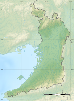
| Location | 1-9-26 Shōwachō, Abeno-ku, Osaka, Osaka Japan | ||||||||||
| Operated by | |||||||||||
| Line(s) | |||||||||||
| Distance | 15.7 km (9.8 mi) from Esaka | ||||||||||
| Platforms | 2 side platforms | ||||||||||
| Tracks | 2 | ||||||||||
| Construction | |||||||||||
| Structure type | Underground | ||||||||||
| Accessible | Yes | ||||||||||
| Other information | |||||||||||
| Station code | M 24 | ||||||||||
| Website | Official website | ||||||||||
| History | |||||||||||
| Opened | 20 December 1951 | ||||||||||
| Passengers | |||||||||||
| FY2011 | 22,741 daily | ||||||||||
| Services | |||||||||||
| |||||||||||
| |||||||||||
Shōwachō Station (昭和町駅, Shōwachō-eki) is a subway station on the Osaka Metro Midōsuji Line in Abeno-ku, Osaka, Japan, south east of Tennoji. The station is numbered "M24".
While situated relatively close to Fuminosato Station on the Tanimachi Line, there are no transfer passageways between the two stations.
Lines
[edit]Shōwachō Station is served by the Midōsuji Line, and is located 15.7 km from the starting point of the line at Esaka.[1]
Station layout
[edit]There are two side platforms with two tracks under Abiko-suji, on the second basement ("B2F") level.
Platforms
[edit]
| 1 | ■ Midōsuji Line | for Abiko and Nakamozu |
| 2 | ■ Midōsuji Line | for Tennōji, Namba, Umeda, and Minoh-kayano |
History
[edit]The station opened on 20 December 1951.[1]
Passenger statistics
[edit]In fiscal 2011, the station was used by an average of 22,741 passengers daily.[1]
Surrounding area
[edit]The station is located in a largely residential area; there are convenience stores, small izakayas, and a covered shopping street of local independent traders.
- Fuminosato Station (Tanimachi Line)
- Okazakiya
- Momogaike Park
- Shodokan Aikido Hombu Dojo (the head dojo of Shodokan Aikido)
See also
[edit]References
[edit]- ^ a b c Terada, Hirokazu (19 January 2013). データブック日本の私鉄 [Databook: Japan's Private Railways] (in Japanese). Japan: Neko Publishing. p. 283. ISBN 978-4-7770-1336-4.


