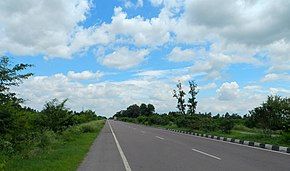
National Highway 24 (India)
Appearance
(Redirected from National Highway 29 (India)(old numbering))
| National Highway 24 | ||||
|---|---|---|---|---|
 | ||||
| Route information | ||||
| Length | 293 km (182 mi) | |||
| Major junctions | ||||
| North end | Sonauli | |||
| South end | Saiyad Raja | |||
| Location | ||||
| Country | India | |||
| States | Uttar Pradesh | |||
| Highway system | ||||
| ||||
National Highway 24 (NH 24) is a primary national highway in India, running in a north–south direction. This highway runs entirely in the state of Uttar Pradesh.[1] This highway was created by renumbering former NH29 and NH97 as per new numbering system of national highways.[2]
Route
[edit]NH24 connects Sonauli (Indo/Nepal border), Nautanwa, Kolhui, Pharenda, Campierganj, Rawatganj, Gorakhpur, Bhaurapur, Kauriram, Barhalganj, Doharighat, Ghosi, Mau, Mardah, Ghazipur, Zamania and Saiyad Raja in the state of Uttar Pradesh.[2][3]
Junctions
[edit]This article contains a bulleted list or table of intersections which should be presented in a properly formatted junction table. (November 2021) |
 H08 Siddhartha Highway - Terminal Junction at India/Nepal border.
 NH 730 near Pharenda (Anandnagar)
 NH 328 near Campierganj
 NH 727BB near Gorakhpur
 NH 27 near Gorakhpur
 NH 227A near Barhalganj
 NH 128C near Dohrighat
 NH 128D near Mau
 NH 31 near Ghazipur
 NH 124C near Medinipur
 NH 19 Terminal near Saiyad Raja.[2]
See also
[edit]References
[edit]- ^ "Rationalisation of Numbering Systems of National Highways" (PDF). New Delhi: Department of Road Transport and Highways. Archived from the original (PDF) on 1 February 2016. Retrieved 3 April 2012.
- ^ a b c "New Numbering of National Highways notification - Government of India" (PDF). The Gazette of India. Archived (PDF) from the original on 4 May 2018. Retrieved 14 March 2019.
- ^ "State-wise length of National Highways (NH) in India". Ministry of Road Transport and Highways. Archived from the original on 4 June 2019. Retrieved 14 March 2019.
External links
[edit]


