Maple Street Bridge (Spokane, Washington)
Maple Street Bridge | |
|---|---|
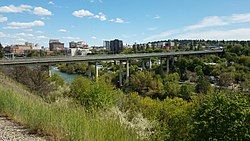
 View from northwest at Kendall Yards in 2020 | |
| Coordinates | 47°39′34″N 117°26′05″W / 47.65944°N 117.43472°W |
| Carries | Automobiles, Trucks, Pedestrians |
| Crosses | Spokane River and Peaceful Valley |
| Locale | Spokane, Washington U.S. |
| Other name(s) | Maple Street Toll Bridge (1958–1990) |
| Named for | Maple Street |
| Owner | City of Spokane Department of Streets |
| Characteristics | |
| Design | Girder bridge |
| Total length | 1,708 feet (521 m)[1] |
| Height | 125 feet (38 m) |
| No. of lanes | 4[1][2] |
| History | |
| Construction start | 1956 |
| Construction cost | $6 million (1956)[3] ($67.2 million in 2025[4]) |
| Opened | July 1, 1958[1][2] |
| Statistics | |
| Daily traffic | 40,600 (2015) |
| Toll | $0.10 (1958–1981) $0.25 (1981–1990) Toll removed in 1990 |
| Location | |
 | |
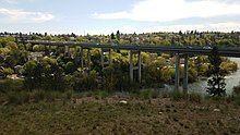
The Maple Street Bridge is a girder bridge in the northwest United States in Spokane, Washington. It spans West Central to Downtown, crossing over the Spokane River and the Peaceful Valley neighborhood.[5] Along with the Division Street Bridge and Monroe Street Bridge, the Maple Street Bridge is one of several major bridges that cross the Spokane River.[6]
The bridge is 1,719 feet (524 m) in length, stands 125 feet (38 m) above the river, with a deck that is fifty feet (15 m) wide.[5] It has two-lane traffic in both directions,[2] and a caged pedestrian walkway. As of 2015, the Maple Street Bridge has an average daily traffic of 40,600 vehicles.[6]
History
[edit]
Construction began in 1956 and the Maple Street Bridge opened on July 1, 1958.[1][7] The bridge cost $6 million dollars to construct,[1][8] and required a ten-cent toll on vehicles from 1958 to 1981.[9] During the first three hours, over 1,600 vehicles crossed the new bridge.[10] The price was raised to 25 cents from 1981 to 1990, when the toll was removed.[7]
Accidents
[edit]During construction in December 1957, an iron worker was killed when he fell ninety feet (27 m) from a wooden platform.[11][12]
In 2008, a teen died by accidentally falling from the Maple Street Bridge.[13]
See also
[edit]List of crossings of the Spokane River
References
[edit]- ^ a b c d e "Maple Street Bridge Opened". Spokane Daily Chronicle. July 1, 1958. p. 1.
- ^ a b c "Cars to roll over Maple span today". Spokesman-Review. July 1, 1958. p. 1.
- ^ "Maple bridge ready for opening tomorrow". Spokane Daily Chronicle. June 30, 1958. p. 14.
- ^ 1634–1699: McCusker, J. J. (1997). How Much Is That in Real Money? A Historical Price Index for Use as a Deflator of Money Values in the Economy of the United States: Addenda et Corrigenda (PDF). American Antiquarian Society. 1700–1799: McCusker, J. J. (1992). How Much Is That in Real Money? A Historical Price Index for Use as a Deflator of Money Values in the Economy of the United States (PDF). American Antiquarian Society. 1800–present: Federal Reserve Bank of Minneapolis. "Consumer Price Index (estimate) 1800–". Retrieved February 29, 2024.
- ^ a b "Maple Street Bridge". Bridgehunter.com.
- ^ a b Tinsley, Jesse (April 1, 2019). "Then and Now: Maple Street Bridge". The Spokesman-Review. Retrieved November 8, 2022.
- ^ a b "MAPLE STREET over SPOKANE RIVER Spokane County, Washington Bridge Inspection Report". Tallahassee Democrat.
- ^ Cherny, Nikolai. "The Maple Street Bridge". Spokane Historical.
- ^ Roberts, Jack (March 6, 1981). "Toll hike plan dies". Spokesman-Review. p. 16.
- ^ "1617 cars use new span in first 3 hours of toll". Spokesman-Review. July 2, 1958. p. 1.
- ^ "Bridge worker dies in fall". Spokane Daily Chronicle. December 27, 1957. p. 1.
- ^ "90-foot fall kills Spokane iron worker worker". Lewiston Morning Tribune. Associated Press. December 28, 1957. p. 6.
- ^ "Teen dies after falling from the Maple Street Bridge". KHQ. April 4, 2008.
- Buildings and structures in Spokane, Washington
- Transportation in Spokane, Washington
- Bridges completed in 1958
- 1958 establishments in Washington (state)
- Transportation buildings and structures in Spokane County, Washington
- Western United States bridge (structure) stubs
- Washington (state) building and structure stubs
- Washington (state) transportation stubs
